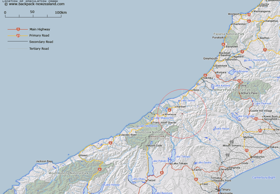
Map showing location of Speculation Creek


LINZ description: Flows northerly from Speculation Ridge to Hot Springs Creek. Poerua Survey District
Latitude: -43.250843
Longitude: 170.660504
Northing: 5208671.5
Easting: 1410085.8
Land District: Westland
Feat Type: Stream


Scroll down to see a more detailed road map and below that a topographical map showing the location of Speculation Creek. The road map has been supplied by openstreetmap and the topographical map of Speculation Creek has been supplied by Land Information New Zealand (LINZ).

Yes you can use the top static map for you school/university project or personal website with a link back. Contact me for any commercial use.

Speculation Creek Map New Zealand


New Zealand places in our database
[ A ] [ B ] [ C ] [ D ] [ E ] [ F ] [ G ] [ H ] [ I ] [ J ] [ K ] [ L ] [ M ] [ N ] [ O ] [ P ] [ Q ] [ R ] [ S ] [ T ] [ U ] [ V ] [ W ] [ X ] [ Y ] [ Z ]


Closest 20 Streams to Speculation Creek

Hot Spring Creek ( 1.18km )   Avalon Creek ( 1.95km )   Boulderpool Creek ( 2.11km )   Athene Creek ( 2.33km )   Cathedral Creek ( 2.41km )   Alpheus Creek ( 3.98km )   Adamson Creek ( 4.37km )   Adams River ( 4.39km )   Aciphylla Creek ( 4.74km )   Isobel Creek ( 4.96km )   Wilberg River ( 5.4km )   Willberg River ( 5.4km )   Steep Creek ( 6.03km )   Tribute Creek ( 6.04km )   Hendes Creek ( 6.06km )   Halo Creek ( 6.66km )   Vapour Creek ( 6.67km )   Vista Creek ( 7.27km )   Ally Trickle ( 7.28km )   Prattle Stream ( 7.48km )   Lambert River ( 7.93km )   Incense Creek ( 7.99km )   Benighted Creek ( 8.36km )   Peter Creek ( 8.58km )   Dam Creek ( 8.62km )   White Water ( 8.87km )   Even Flow Stream ( 9.08km )   Wanganui River ( 9.09km )   Rifle Torrent ( 9.16km )   Lord River ( 9.24km )   Froth Creek ( 9.67km )   Glamour Torrent ( 9.75km )   McClausland Creek ( 10.02km )   Corridor Creek ( 10.09km )   Slide Stream ( 10.22km )   Harold Creek ( 10.32km )   Tarpot Creek ( 10.33km )   Rata Creek ( 10.41km )   Adverse Creek ( 10.59km )   Hunker Torrent ( 10.6km )