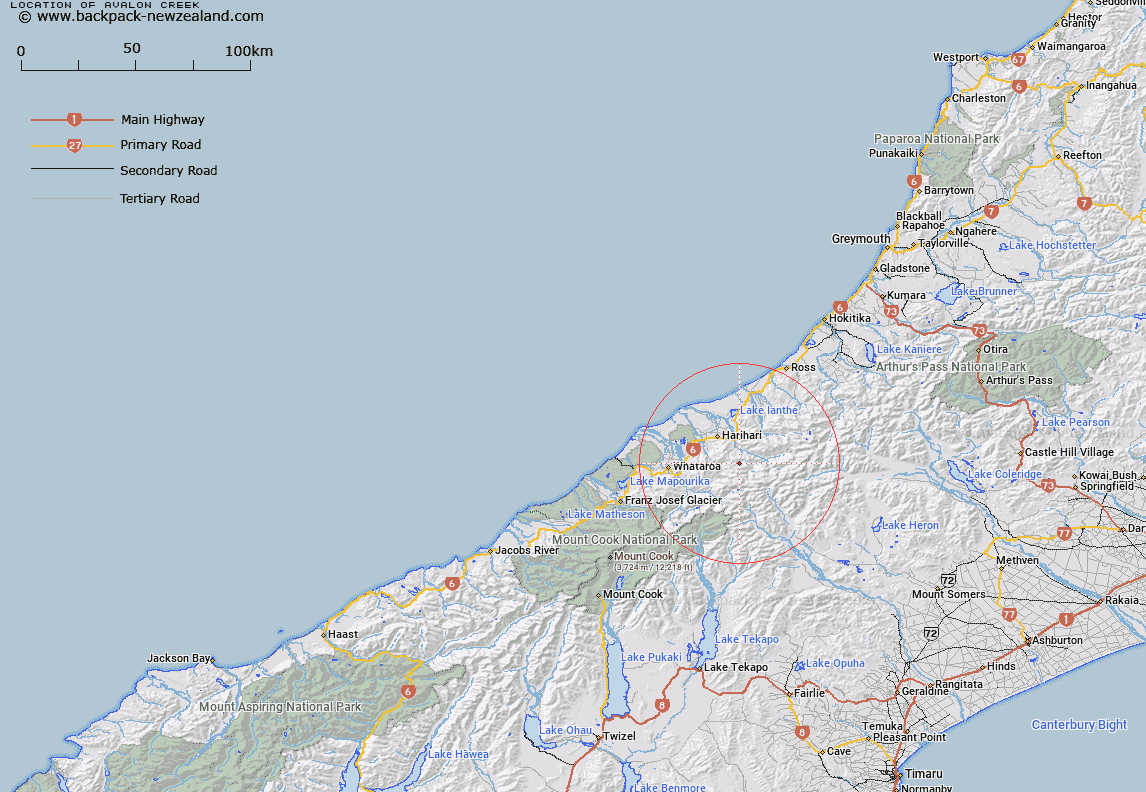
Map showing location of Avalon Creek


LINZ description: Flowing from small glacier south-east of Avalon Peak into Hot Springs Creek. Poerua Survey District.
Latitude: -43.248584
Longitude: 170.636592
Northing: 5208867.7
Easting: 1408137.5
Land District: Westland
Feat Type: Stream


Scroll down to see a more detailed road map and below that a topographical map showing the location of Avalon Creek. The road map has been supplied by openstreetmap and the topographical map of Avalon Creek has been supplied by Land Information New Zealand (LINZ).

Yes you can use the top static map for you school/university project or personal website with a link back. Contact me for any commercial use.

Avalon Creek Map New Zealand


New Zealand places in our database
[ A ] [ B ] [ C ] [ D ] [ E ] [ F ] [ G ] [ H ] [ I ] [ J ] [ K ] [ L ] [ M ] [ N ] [ O ] [ P ] [ Q ] [ R ] [ S ] [ T ] [ U ] [ V ] [ W ] [ X ] [ Y ] [ Z ]


Closest 20 Streams to Avalon Creek

Hot Spring Creek ( 1.08km )   Speculation Creek ( 1.95km )   Cathedral Creek ( 2.02km )   Wilberg River ( 3.46km )   Willberg River ( 3.46km )   Athene Creek ( 3.54km )   Adamson Creek ( 3.56km )   Boulderpool Creek ( 3.79km )   Tribute Creek ( 4.77km )   Alpheus Creek ( 4.9km )   Adams River ( 6.28km )   Isobel Creek ( 6.42km )   Aciphylla Creek ( 6.46km )   Halo Creek ( 6.49km )   Hendes Creek ( 6.65km )   Prattle Stream ( 7.06km )   Steep Creek ( 7.25km )   Vista Creek ( 7.33km )   Incense Creek ( 7.4km )   McClausland Creek ( 8.08km )   Vapour Creek ( 8.26km )   Wanganui River ( 8.4km )   Rata Creek ( 8.53km )   Ally Trickle ( 8.89km )   Harold Creek ( 9.15km )   Dam Creek ( 9.3km )   Tom Creek ( 9.48km )   North Barlow River ( 9.6km )   White Water ( 9.76km )   Lambert River ( 9.8km )   Dry Creek ( 9.87km )   Peter Creek ( 9.88km )   Snake Creek ( 9.89km )   Tarpot Creek ( 9.9km )   Perverse Creek ( 10.01km )   Corridor Creek ( 10.11km )   Benighted Creek ( 10.19km )   Adverse Creek ( 10.29km )   Slide Stream ( 10.56km )   Even Flow Stream ( 10.62km )