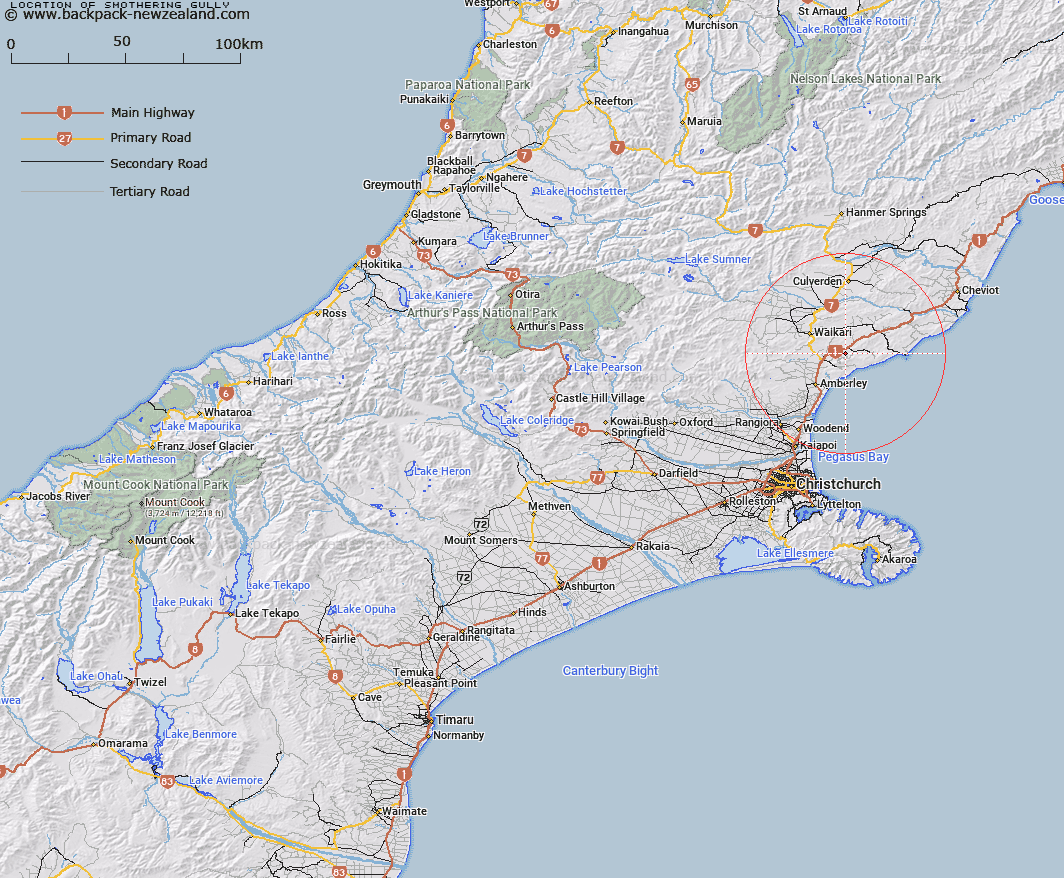
Map showing location of Smothering Gully


LINZ description: Large gully flowing north from high point Totara to Omihi Stream
Latitude: -43.042088
Longitude: 172.845714
Northing: 5234499.8
Easting: 1587432.9
Land District: Canterbury
Feat Type: Valley


Scroll down to see a more detailed road map and below that a topographical map showing the location of Smothering Gully. The road map has been supplied by openstreetmap and the topographical map of Smothering Gully has been supplied by Land Information New Zealand (LINZ).

Yes you can use the top static map for you school/university project or personal website with a link back. Contact me for any commercial use.

Smothering Gully Map New Zealand


New Zealand places in our database
[ A ] [ B ] [ C ] [ D ] [ E ] [ F ] [ G ] [ H ] [ I ] [ J ] [ K ] [ L ] [ M ] [ N ] [ O ] [ P ] [ Q ] [ R ] [ S ] [ T ] [ U ] [ V ] [ W ] [ X ] [ Y ] [ Z ]


Closest 20 Valleys to Smothering Gully

Ohuriawa Gorge ( 23.36km )   Gum Tree Gully ( 27.36km )   Reservoir Gully ( 29.52km )   Freezing Gully ( 35.05km )   Happy Valley ( 36.28km )   Langs Gully ( 36.46km )   Hughs Gully ( 37.34km )   Hurricane Gully ( 37.99km )   Pig Gully ( 38.2km )   Dynamite Gully ( 38.91km )   Boil Gully ( 39.17km )   Deer Wallow Gully ( 40.88km )   Tweedies Gully ( 41.91km )   Cathedral Gully ( 42.1km )   Wooded Gully ( 45.35km )   Soda Gully ( 45.44km )   Boundary Gully ( 48.48km )   Seagull Gully ( 49.14km )   Gabriels Gully ( 52.12km )   Old House Gully ( 53.63km )   Tent Gully ( 55.37km )   Long Gully ( 57.08km )   Dismal Valley ( 57.59km )   Sawpit Gully ( 58.84km )   Knowles Gully ( 60.11km )   Jones Gully ( 61.1km )   Big Bush Gully ( 61.51km )   Ghost Gully ( 64.29km )   Magdalen Valley ( 66.18km )   Williams Valley ( 67.16km )   Church Gully ( 67.46km )   Haircut Gully ( 67.92km )   Mitchells Cutting ( 68.18km )   The Narrows ( 68.64km )   Black Gate Gully ( 69.15km )   Peters Valley ( 70.22km )   Bush Gully ( 70.93km )   Mikes Gully ( 71.34km )   Starvation Gully ( 72.45km )   Carrington Gorge ( 72.99km )