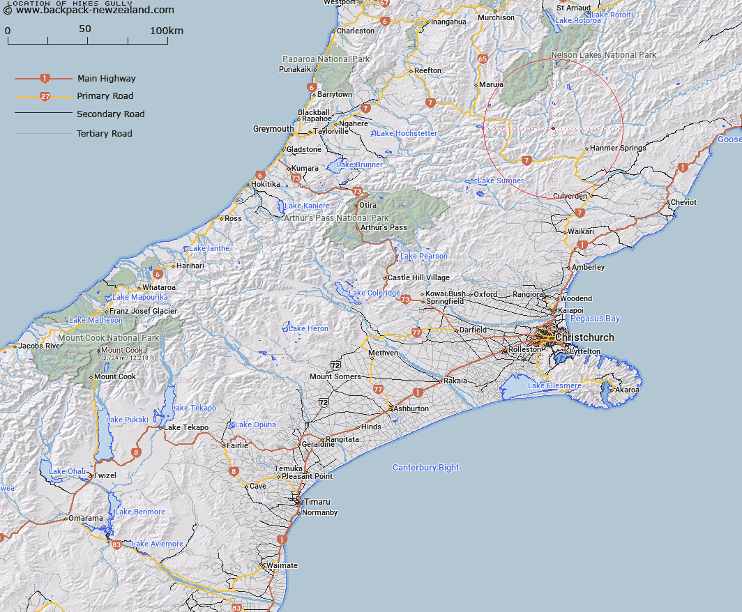
Map showing location of Mikes Gully


LINZ description: Small gully running into Edwards River south of Plinlimmon.
Latitude: -42.41733
Longitude: 172.646879
Northing: 5303826
Easting: 1570947.2
Land District: Canterbury
Feat Type: Valley


Scroll down to see a more detailed road map and below that a topographical map showing the location of Mikes Gully. The road map has been supplied by openstreetmap and the topographical map of Mikes Gully has been supplied by Land Information New Zealand (LINZ).

Yes you can use the top static map for you school/university project or personal website with a link back. Contact me for any commercial use.

Mikes Gully Map New Zealand


New Zealand places in our database
[ A ] [ B ] [ C ] [ D ] [ E ] [ F ] [ G ] [ H ] [ I ] [ J ] [ K ] [ L ] [ M ] [ N ] [ O ] [ P ] [ Q ] [ R ] [ S ] [ T ] [ U ] [ V ] [ W ] [ X ] [ Y ] [ Z ]


Closest 20 Valleys to Mikes Gully

Stanley Gates ( 4.41km )   The Narrows ( 6.53km )   Peters Valley ( 8.58km )   Williams Valley ( 10.26km )   Sawpit Gully ( 12.53km )   Aniseed Valley ( 12.65km )   Bushy Corner Gully ( 13.03km )   Ghost Gully ( 13.17km )   Magdalen Valley ( 14.07km )   Long Gully ( 14.73km )   Straight Gully ( 15.41km )   Leader Dale ( 17.24km )   Camera Gully ( 18.89km )   Gabriels Gully ( 19.27km )   Bush Gully ( 20.1km )   Cannibal Gorge ( 20.53km )   Glacier Gully ( 21.17km )   Deer Valley ( 22.31km )   Mitchells Cutting ( 22.65km )   Dismal Valley ( 29.44km )   Island Gully ( 32.39km )   Rag and Famish Gully ( 33.63km )   Dynamite Gully ( 33.76km )   Hughs Gully ( 34.62km )   The Sluice Box ( 35.7km )   Freezing Gully ( 36.47km )   Bullock Gully ( 38.35km )   Horse Gully ( 41.37km )   Travellers Valley ( 42.86km )   Wairau Gorge ( 45.42km )   Old House Gully ( 50.61km )   Flapper Gully ( 52.22km )   Hurricane Gully ( 53.68km )   The Lovers Walk ( 54km )   Boundary Gully ( 54.14km )   Pig Gully ( 59.43km )   Gentle Annie Gorge ( 59.47km )   Guide Gully ( 59.69km )   Langs Gully ( 60.73km )   Soda Gully ( 62.52km )