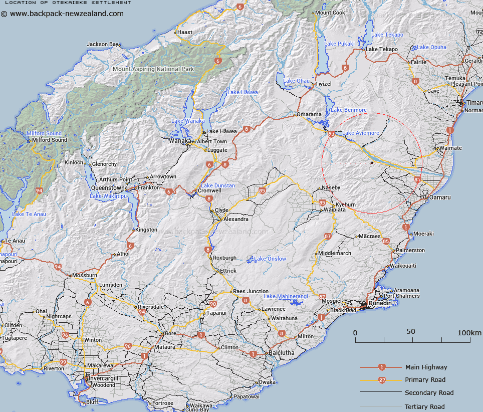
Map showing location of Otekaieke Settlement


LINZ description: Land Registration District covering an area on both sides of the Otakaieke River. Maerewhenua Survey District.
Latitude: -44.837838
Longitude: 170.547695
Northing: 5032137.9
Easting: 1406176.1
Land District: Otago
Feat Type: Appellation


Scroll down to see a more detailed road map and below that a topographical map showing the location of Otekaieke Settlement. The road map has been supplied by openstreetmap and the topographical map of Otekaieke Settlement has been supplied by Land Information New Zealand (LINZ).

Yes you can use the top static map for you school/university project or personal website with a link back. Contact me for any commercial use.

Otekaieke Settlement Map New Zealand


New Zealand places in our database
[ A ] [ B ] [ C ] [ D ] [ E ] [ F ] [ G ] [ H ] [ I ] [ J ] [ K ] [ L ] [ M ] [ N ] [ O ] [ P ] [ Q ] [ R ] [ S ] [ T ] [ U ] [ V ] [ W ] [ X ] [ Y ] [ Z ]


Closest 20 Appellations to Otekaieke Settlement

Maruwenua Settlement ( 17.43km )   Maerewhenua ( 17.43km )   Maruwhenua Settlement ( 17.43km )   Kauru ( 30.31km )   Maniototo Survey District ( 48.63km )   Portobello Survey District ( 110.01km )   Portobello Bay Survey District ( 110.01km )   Pohaturoha ( 290.87km )   Pohaturoa ( 290.87km )   Whangamoa Survey District ( 489.07km )   Wangamoa ( 489.07km )   Ohariu ( 526.14km )   Waitetuna Block ( 530.89km )   Waitutuma Block ( 530.89km )   Whatarangi Block ( 531.32km )   Waitarangi Block ( 531.32km )   Tukapu Registration District ( 538.94km )   Takapu Registration District ( 538.94km )   Parimu Settlement ( 600.43km )   Paramu Settlement ( 600.43km )   Maungarake Block ( 602.93km )   Maungaraki Block ( 602.93km )   Okurupeti ( 607.59km )   Okurupatu Block ( 607.59km )   Eperaima Block ( 607.66km )   Eparaima Block ( 607.66km )   Te Kawau Survey District ( 637.61km )   Te Kauwau ( 637.61km )   Parewanui Maori Block ( 643.67km )   Otautu Maori Block ( 657.13km )   Otauto Maori Block ( 657.13km )   Tokamaru Maori Block ( 673.14km )   Tokomaru Maori Block ( 673.14km )   Marakeke ( 721.27km )   Maharakeke Settlement ( 721.27km )   Kahuranaki Crown Grant District ( 764.16km )   Kauranaki Crown Grant District ( 764.16km )   Paepaetahi ( 781.17km )   Paipaitahi ( 781.17km )   Hawke's Bay Land District ( 792.01km )