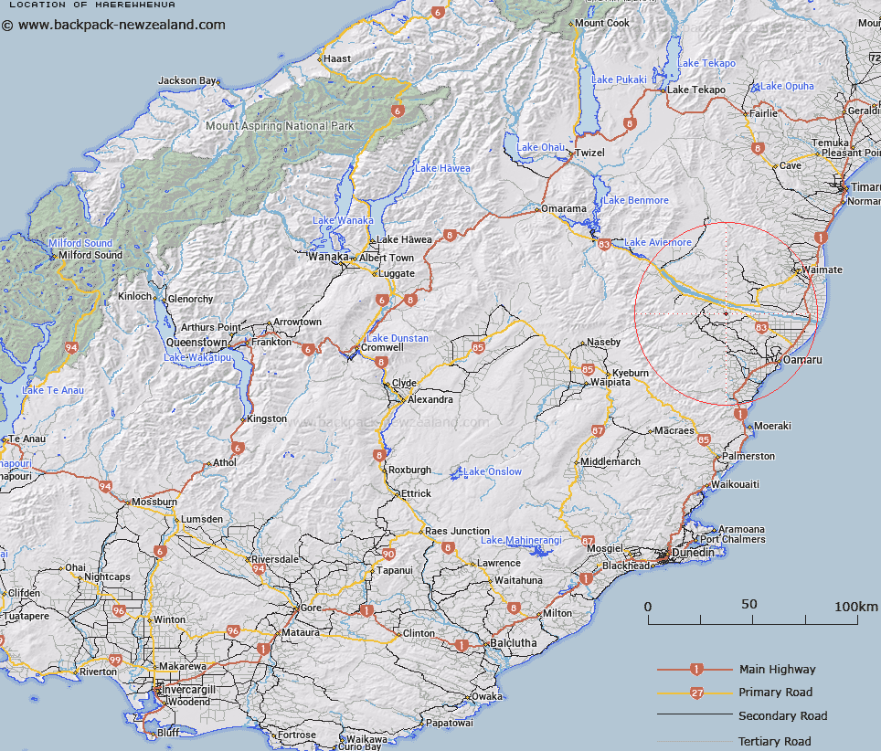
Map showing location of Maerewhenua


LINZ description: Land Registration District situated on the South Bank of the Waitaki River as shown on Otago SO Plans 2166 to 2169. Maerewhenua Survey District.
Latitude: -44.904697
Longitude: 170.74776
Northing: 5025168.9
Easting: 1422194.8
Land District: Otago
Feat Type: Appellation


Scroll down to see a more detailed road map and below that a topographical map showing the location of Maerewhenua. The road map has been supplied by openstreetmap and the topographical map of Maerewhenua has been supplied by Land Information New Zealand (LINZ).

Yes you can use the top static map for you school/university project or personal website with a link back. Contact me for any commercial use.

Maerewhenua Map New Zealand


New Zealand places in our database
[ A ] [ B ] [ C ] [ D ] [ E ] [ F ] [ G ] [ H ] [ I ] [ J ] [ K ] [ L ] [ M ] [ N ] [ O ] [ P ] [ Q ] [ R ] [ S ] [ T ] [ U ] [ V ] [ W ] [ X ] [ Y ] [ Z ]


Closest 20 Appellations to Maerewhenua

Otekaike Settlement ( 17.43km )   Otekaieke Settlement ( 17.43km )   Kauru ( 20.74km )   Maniototo Survey District ( 56.33km )   Portobello Bay Survey District ( 101.91km )   Portobello Survey District ( 101.91km )   Pohaturoha ( 292.15km )   Pohaturoa ( 292.15km )   Whangamoa Survey District ( 487.2km )   Wangamoa ( 487.2km )   Ohariu ( 521.47km )   Waitutuma Block ( 524.29km )   Waitetuna Block ( 524.29km )   Waitarangi Block ( 525.13km )   Whatarangi Block ( 525.13km )   Tukapu Registration District ( 534.17km )   Takapu Registration District ( 534.17km )   Paramu Settlement ( 593.99km )   Parimu Settlement ( 593.99km )   Maungarake Block ( 596.7km )   Maungaraki Block ( 596.7km )   Eparaima Block ( 600.85km )   Eperaima Block ( 600.85km )   Okurupeti ( 601.71km )   Okurupatu Block ( 601.71km )   Te Kawau Survey District ( 633.45km )   Te Kauwau ( 633.45km )   Parewanui Maori Block ( 639.79km )   Otauto Maori Block ( 655.6km )   Otautu Maori Block ( 655.6km )   Tokomaru Maori Block ( 670.49km )   Tokamaru Maori Block ( 670.49km )   Maharakeke Settlement ( 715.84km )   Marakeke ( 715.84km )   Kahuranaki Crown Grant District ( 758.5km )   Kauranaki Crown Grant District ( 758.5km )   Paepaetahi ( 775.93km )   Paipaitahi ( 775.93km )   Hawke's Bay Land District ( 786.83km )   Mangapehi ( 804.66km )