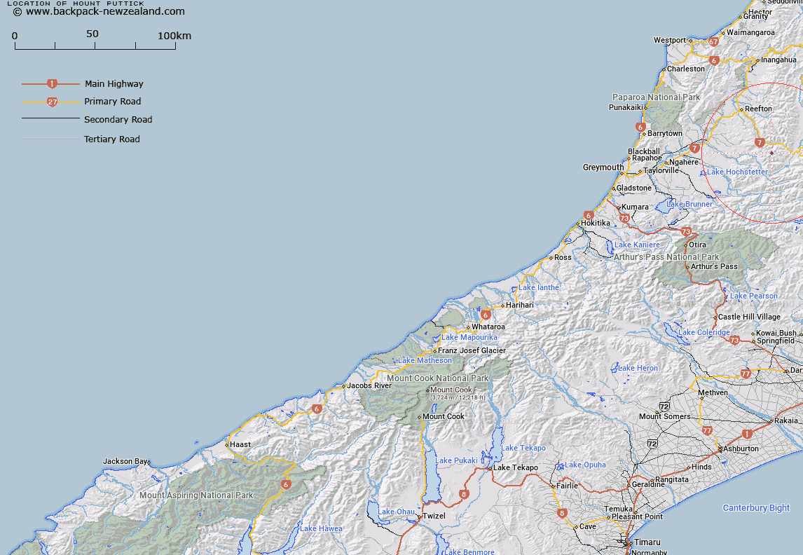
Map showing location of Mount Puttick


LINZ description: At the head of the Brown, Grey, and Otto Rivers
Latitude: -42.343758
Longitude: 172.029996
Northing: 5311600
Easting: 1520100
Land District: Westland
Feat Type: Hill


Scroll down to see a more detailed road map and below that a topographical map showing the location of Mount Puttick. The road map has been supplied by openstreetmap and the topographical map of Mount Puttick has been supplied by Land Information New Zealand (LINZ).

Yes you can use the top static map for you school/university project or personal website with a link back. Contact me for any commercial use.

Mount Puttick Map New Zealand


New Zealand places in our database
[ A ] [ B ] [ C ] [ D ] [ E ] [ F ] [ G ] [ H ] [ I ] [ J ] [ K ] [ L ] [ M ] [ N ] [ O ] [ P ] [ Q ] [ R ] [ S ] [ T ] [ U ] [ V ] [ W ] [ X ] [ Y ] [ Z ]


Closest 20 Hills to Mount Puttick

Mount Beckman ( 1.14km )   Mount Hunter ( 2.19km )   Conical Hill ( 4.43km )   Mount Kemp ( 4.48km )   Mount Haast ( 5.36km )   Mount Gore ( 5.41km )   Pinnacle ( 7.07km )   Mount Alexander ( 7.61km )   Mount Penneal ( 7.97km )   Windy Point ( 10.56km )   Mount Harata ( 10.79km )   Bald Hill ( 10.99km )   Mount Ross ( 11.91km )   Mount Blackadder ( 12.43km )   Mount Rameses ( 12.5km )   Turpentine ( 12.61km )   Slate Slip Hill ( 12.97km )   Marble Hill ( 14.75km )   The Pyramid ( 15.78km )   Ivess Peak ( 17.05km )   Mount Albert ( 17.13km )   Mount Hochstetter ( 18.76km )   Baldy ( 19.48km )   Mount Novaro ( 19.85km )   Globe Hill ( 21.42km )   Mount Barron ( 21.71km )   Mount Mueller ( 21.94km )   Mount Boscawen ( 22km )   Mount Elliot ( 22.94km )   Mount Hatless ( 23.81km )   The Grand Duchess ( 24.16km )   Mount Carrington ( 25.39km )   The Apprentice ( 25.99km )   Lucretia ( 26km )   The Devils Rampart ( 26.08km )   Mount Quail ( 26.29km )   Mount Lakeman ( 26.67km )   Creighton Peak ( 27.39km )   Mount Ajax ( 27.46km )   Kirwans Hill ( 27.48km )