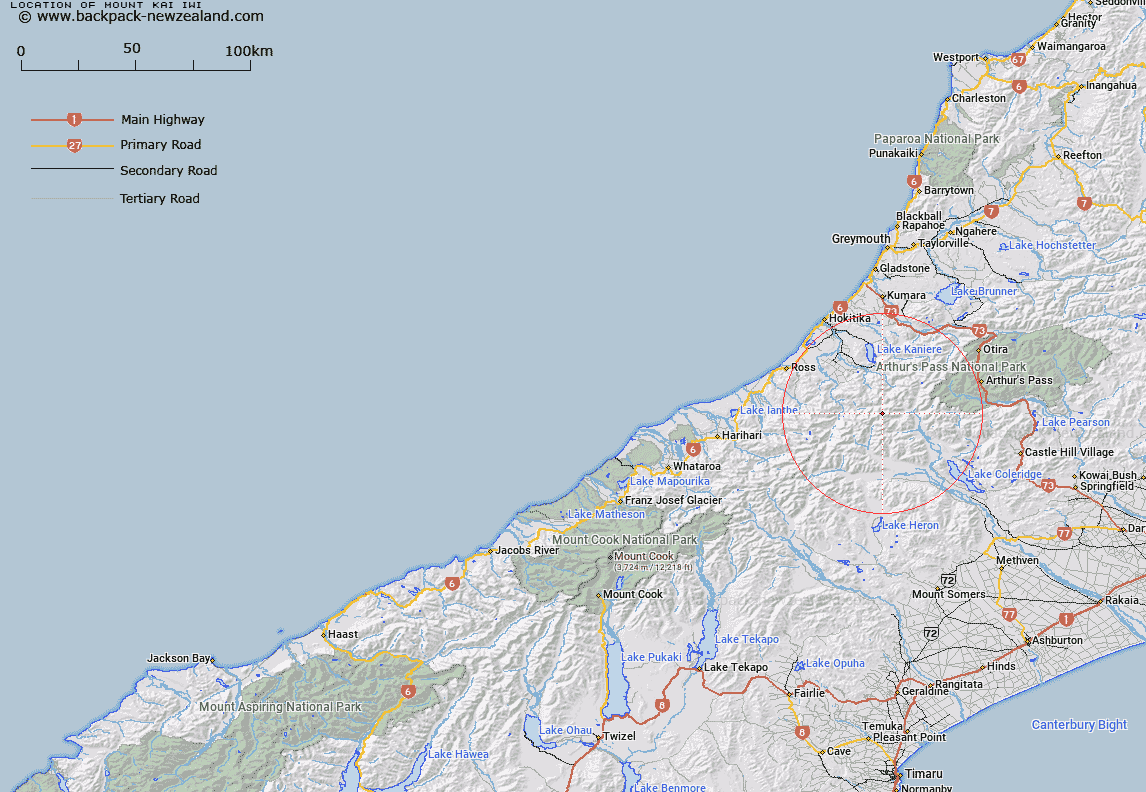
Map showing location of Mount Kai Iwi


LINZ description: On Main Divide, north-east of Mount Harrison, 6,843 ft. Instead of Mount Collet
Latitude: -43.06488
Longitude: 171.185423
Northing: 5230382.6
Easting: 1452250.8
Land District: Westland
Feat Type: Hill


Scroll down to see a more detailed road map and below that a topographical map showing the location of Mount Kai Iwi. The road map has been supplied by openstreetmap and the topographical map of Mount Kai Iwi has been supplied by Land Information New Zealand (LINZ).

Yes you can use the top static map for you school/university project or personal website with a link back. Contact me for any commercial use.

Mount Kai Iwi Map New Zealand


New Zealand places in our database
[ A ] [ B ] [ C ] [ D ] [ E ] [ F ] [ G ] [ H ] [ I ] [ J ] [ K ] [ L ] [ M ] [ N ] [ O ] [ P ] [ Q ] [ R ] [ S ] [ T ] [ U ] [ V ] [ W ] [ X ] [ Y ] [ Z ]


Closest 20 Hills to Mount Kai Iwi

Mystery Peak ( 0.38km )   Mount Harrison ( 0.73km )   Shafto Peak ( 1.34km )   Mount Bryce ( 1.37km )   Mount Kensington ( 1.72km )   Mount Ballance ( 2.04km )   Mount Stout ( 2.45km )   Mount Treadwell ( 2.73km )   Mungo Peak ( 2.99km )   Mount Notman ( 3km )   Mount Park ( 3.45km )   Mount Tregear ( 4.22km )   Gerard Peak ( 4.63km )   Mount Eliot ( 5km )   Mount Eliott ( 5km )   Mount Bannatyne ( 5.67km )   Mount Tancred ( 5.84km )   Mount Chamberlain ( 6.91km )   Mount Chamberlin ( 6.91km )   The Rampart ( 7.11km )   Monarch Hill ( 7.13km )   Mount Ross ( 7.16km )   Flat Hill ( 7.39km )   Bastion Ridge ( 7.46km )   Mount Meta ( 7.5km )   Mount Ambrose ( 7.85km )   Mount Frieda ( 8.31km )   Urquhart Peak ( 8.31km )   Mount Marion ( 8.43km )   Mount Carl ( 8.51km )   Commodore Peak ( 8.66km )   Comyns Peak ( 8.67km )   Mount Findlay ( 9.07km )   Vincent Peak ( 9.13km )   Button Peak ( 9.57km )   Moa Hill ( 9.77km )   Mount O'Connor ( 10.62km )   Mount Reeves ( 10.72km )   Mount Ethel ( 10.76km )   Mount Cabot ( 10.82km )