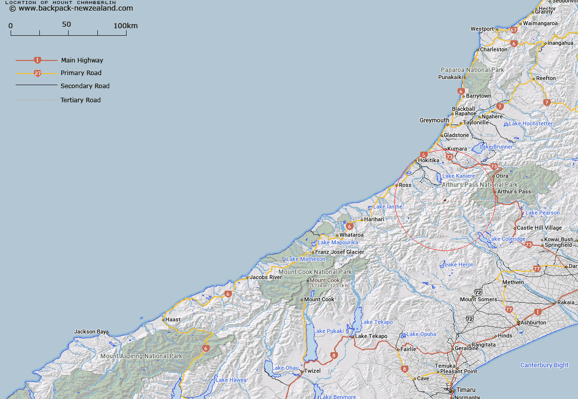
Map showing location of Mount Chamberlin


LINZ description: In Toaroha Range, height 1786 m, south-east of Hokitika. Topo50 map, BV19 - Lake Kaniere, GR 521 372.
Latitude: -43.002741
Longitude: 171.186165
Northing: 5237284.6
Easting: 1452162.1
Land District: Westland
Feat Type: Hill


Scroll down to see a more detailed road map and below that a topographical map showing the location of Mount Chamberlin. The road map has been supplied by openstreetmap and the topographical map of Mount Chamberlin has been supplied by Land Information New Zealand (LINZ).

Yes you can use the top static map for you school/university project or personal website with a link back. Contact me for any commercial use.

Mount Chamberlin Map New Zealand


New Zealand places in our database
[ A ] [ B ] [ C ] [ D ] [ E ] [ F ] [ G ] [ H ] [ I ] [ J ] [ K ] [ L ] [ M ] [ N ] [ O ] [ P ] [ Q ] [ R ] [ S ] [ T ] [ U ] [ V ] [ W ] [ X ] [ Y ] [ Z ]


Closest 20 Hills to Mount Chamberlin

Bastion Ridge ( 1.25km )   Mount Bannatyne ( 1.4km )   The Rampart ( 1.9km )   Mount Reeves ( 3.82km )   Mount Ambrose ( 3.9km )   Commodore Peak ( 4.53km )   Mount Park ( 4.93km )   Mount Ross ( 5km )   Mount Eliot ( 5.59km )   Mount Eliott ( 5.59km )   Allan Knob ( 6.37km )   Genoa Peak ( 6.72km )   Mungo Peak ( 6.83km )   Flat Hill ( 6.85km )   Mount Kai Iwi ( 6.91km )   Mount Collet ( 6.91km )   Mount Fitzgerald ( 7km )   The Pinnacle ( 7.08km )   Mystery Peak ( 7.08km )   Mount Harrison ( 7.28km )   Crinkle Top ( 7.31km )   Mount Treadwell ( 7.33km )   Mount O'Connor ( 7.41km )   Jumble Top ( 7.54km )   Mount Griffiths ( 7.57km )   Mount Cabot ( 7.63km )   Squall Peak ( 7.64km )   Mount Scott ( 7.89km )   Mount Bryce ( 8km )   Shafto Peak ( 8km )   Mount Camsell ( 8.09km )   Mount Kensington ( 8.13km )   Mount Ballance ( 8.31km )   Sam Knob ( 8.42km )   Mount Keddell ( 8.54km )   Mount Stout ( 8.55km )   Mount Ethel ( 8.64km )   Mount Notman ( 8.92km )   Tyndalls Knob ( 9.75km )   Mount Robinson ( 9.81km )