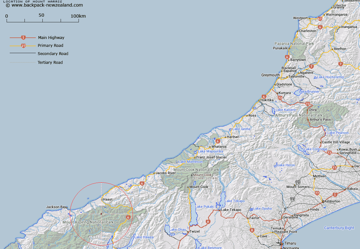
Map showing location of Mount Harris


LINZ description: Peak on Main Divide to west of Ngatau/Okaru River
Latitude: -44.047025
Longitude: 169.037535
Northing: 5115266.2
Easting: 1282555.2
Land District: Westland
Feat Type: Hill


Scroll down to see a more detailed road map and below that a topographical map showing the location of Mount Harris. The road map has been supplied by openstreetmap and the topographical map of Mount Harris has been supplied by Land Information New Zealand (LINZ).

Yes you can use the top static map for you school/university project or personal website with a link back. Contact me for any commercial use.

Mount Harris Map New Zealand


New Zealand places in our database
[ A ] [ B ] [ C ] [ D ] [ E ] [ F ] [ G ] [ H ] [ I ] [ J ] [ K ] [ L ] [ M ] [ N ] [ O ] [ P ] [ Q ] [ R ] [ S ] [ T ] [ U ] [ V ] [ W ] [ X ] [ Y ] [ Z ]


Closest 20 Hills to Mount Harris

Mount Franklin ( 2.39km )   Howe Knob ( 4.81km )   Mount Warren ( 5.3km )   The Round Hill ( 5.31km )   Souter Peak ( 5.53km )   Mount Eggeling ( 5.68km )   Mount Ruera ( 6.52km )   Mount Glissa ( 7.11km )   Foggy Top ( 7.39km )   Mount Lycia ( 7.65km )   Young Peak ( 7.65km )   Misty Peak ( 7.75km )   Mount Attica ( 7.98km )   Mount Doris ( 8.08km )   Mount Selborne ( 8.5km )   Eyetooth ( 8.72km )   Mount Actor ( 9.4km )   Mount Nerger ( 9.55km )   Dizzy Pinnacle ( 10.06km )   The Woolsack ( 10.61km )   Mount Awful ( 10.66km )   Mount Dreadful ( 10.69km )   Mount Argos ( 10.75km )   Mount Marks ( 10.98km )   Mount Mark ( 10.98km )   Mount Action ( 11.58km )   Mount Dispute ( 11.73km )   The Prop ( 11.77km )   Mount Victor ( 11.78km )   Mount Calliope ( 11.79km )   Rough Ridge ( 11.8km )   Trident Peak ( 11.89km )   The Wart ( 12.14km )   Mount Webster ( 12.17km )   Medeon ( 12.54km )   The Rampart ( 13.39km )   The Cairn ( 13.43km )   Topsey ( 13.95km )   Mount Alba ( 14.03km )   Big Bluff ( 14.37km )