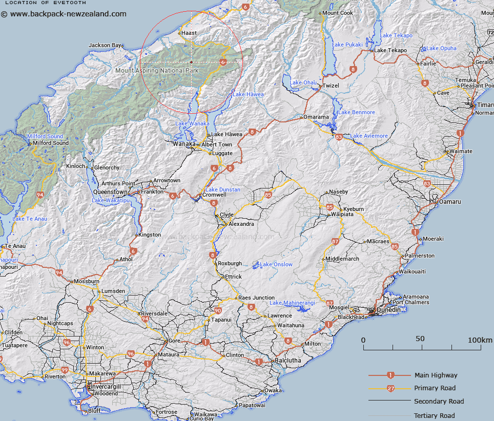
Map showing location of Eyetooth


LINZ description: Peak north of Haunted Spur in between and slightly north of Māori Saddle and Misty Peak.
Latitude: -44.087914
Longitude: 169.130725
Northing: 5111079.8
Easting: 1290235
Land District: Otago, Westland
Feat Type: Hill


Scroll down to see a more detailed road map and below that a topographical map showing the location of Eyetooth. The road map has been supplied by openstreetmap and the topographical map of Eyetooth has been supplied by Land Information New Zealand (LINZ).

Yes you can use the top static map for you school/university project or personal website with a link back. Contact me for any commercial use.

Eyetooth Map New Zealand


New Zealand places in our database
[ A ] [ B ] [ C ] [ D ] [ E ] [ F ] [ G ] [ H ] [ I ] [ J ] [ K ] [ L ] [ M ] [ N ] [ O ] [ P ] [ Q ] [ R ] [ S ] [ T ] [ U ] [ V ] [ W ] [ X ] [ Y ] [ Z ]


Closest 20 Hills to Eyetooth

Mount Actor ( 1.49km )   Misty Peak ( 2.04km )   Mount Argos ( 2.57km )   Foggy Top ( 2.75km )   Mount Glissa ( 4.58km )   Howe Knob ( 4.7km )   Young Peak ( 5.16km )   Topsey ( 5.23km )   Mount Bertha ( 6.46km )   Mount Dana ( 6.52km )   Mount Action ( 6.57km )   Mount Franklin ( 6.61km )   Medeon ( 7.29km )   Mount Victor ( 7.47km )   Citheron ( 7.93km )   The Prop ( 8.03km )   Mount Awful ( 8.04km )   Mount Doris ( 8.32km )   Mount Harris ( 8.72km )   Dizzy Pinnacle ( 9.24km )   Mount Nerger ( 9.98km )   Mount Attica ( 9.99km )   The Rampart ( 10.1km )   Mount Stuart ( 10.34km )   Mount Lycia ( 11.01km )   Mount Webster ( 11.16km )   Mount Ruera ( 11.48km )   Mount Dreadful ( 11.82km )   Mount Cameron ( 11.89km )   Mount Birnam ( 12.04km )   Mount Diomede ( 12.4km )   East Peak ( 12.42km )   Mount Eggeling ( 12.52km )   West Peak ( 12.67km )   Souter Peak ( 12.72km )   Mount Burke ( 12.86km )   Mount Kinross ( 12.92km )   The Keystone ( 13km )   Castle Hill ( 13.22km )   Powder Flask Peak ( 13.28km )