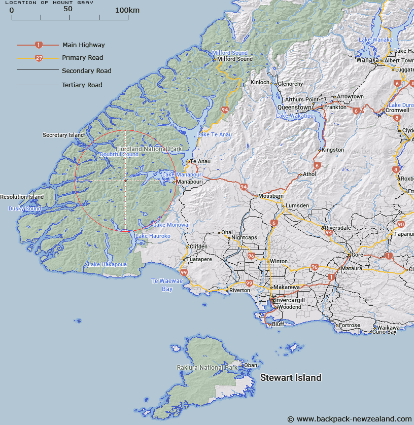
Map showing location of Mount Gray


LINZ description: Mountain at height 1502m situated approximately 4km south-west of the mouth of the Spey River at the West Arm of Lake Manapouri
Latitude: -45.553047
Longitude: 167.247854
Northing: 4939494.4
Easting: 1151039.9
Land District: Southland
Feat Type: Hill


Scroll down to see a more detailed road map and below that a topographical map showing the location of Mount Gray. The road map has been supplied by openstreetmap and the topographical map of Mount Gray has been supplied by Land Information New Zealand (LINZ).

Yes you can use the top static map for you school/university project or personal website with a link back. Contact me for any commercial use.

Mount Gray Map New Zealand


New Zealand places in our database
[ A ] [ B ] [ C ] [ D ] [ E ] [ F ] [ G ] [ H ] [ I ] [ J ] [ K ] [ L ] [ M ] [ N ] [ O ] [ P ] [ Q ] [ R ] [ S ] [ T ] [ U ] [ V ] [ W ] [ X ] [ Y ] [ Z ]


Closest 20 Hills to Mount Gray

Pahiri Peak ( 4.44km )   Mount Watson ( 5.12km )   Koinga Peak ( 5.74km )   Leaning Peak ( 5.75km )   Mount Barber ( 6.29km )   Matterhorn ( 6.4km )   Pinnacle ( 6.75km )   Mount Wilmot ( 6.93km )   Mount Parker ( 7.45km )   Mount Gladstone ( 7.86km )   Mount Memphis ( 7.93km )   Turpentine ( 7.96km )   Mount Ward ( 8km )   Mount Plaisted ( 8km )   Steep Peak ( 8.41km )   Mount Mainwaring ( 8.6km )   Mount Horatio ( 9.52km )   Heywood Peak ( 9.85km )   Mount Bain ( 9.94km )   Black Giants ( 10.08km )   Mount George ( 10.18km )   Precipice Peak ( 11.33km )   Mount Troup ( 11.98km )   McDonnell Peak ( 12.07km )   Mount Menteath ( 12.89km )   Aubrey Peak ( 13.05km )   Mount Thornton ( 13.1km )   Flat Mount ( 13.88km )   Vincent Peak ( 14.05km )   Tripod Hill ( 14.28km )   Mount Reeves ( 14.88km )   Mount Noble ( 15.24km )   Mount Crescent ( 15.41km )   Mount Nantes ( 15.6km )   Mount Crowfoot ( 15.78km )   Saint Pauls Dome ( 16.2km )   Cone Peak ( 16.37km )   Mount Cusack ( 16.48km )   Commander Peak ( 16.55km )   Tamatea Peak ( 16.64km )