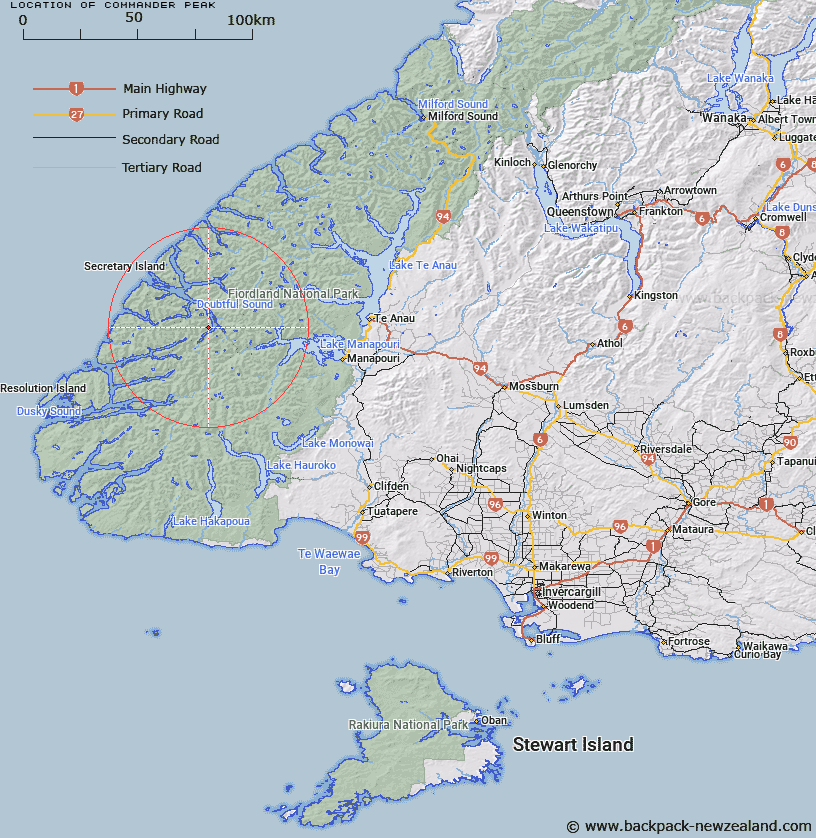
Map showing location of Commander Peak


LINZ description: Peak 1258m above sea level, at the north west end of Hall Arm in Doubtful Sound.
Latitude: -45.447031
Longitude: 167.098756
Northing: 4950423.5
Easting: 1138535.3
Land District: Southland
Feat Type: Hill


Scroll down to see a more detailed road map and below that a topographical map showing the location of Commander Peak. The road map has been supplied by openstreetmap and the topographical map of Commander Peak has been supplied by Land Information New Zealand (LINZ).

Yes you can use the top static map for you school/university project or personal website with a link back. Contact me for any commercial use.

Commander Peak Map New Zealand


New Zealand places in our database
[ A ] [ B ] [ C ] [ D ] [ E ] [ F ] [ G ] [ H ] [ I ] [ J ] [ K ] [ L ] [ M ] [ N ] [ O ] [ P ] [ Q ] [ R ] [ S ] [ T ] [ U ] [ V ] [ W ] [ X ] [ Y ] [ Z ]


Closest 20 Hills to Commander Peak

Mount Troup ( 4.92km )   Mount Danae ( 8.04km )   Black Giants ( 8.31km )   Turpentine ( 8.99km )   Mount Plaisted ( 9.41km )   Mount Mainwaring ( 9.5km )   Mount Wilmot ( 9.7km )   Mount George ( 10.35km )   Mount Barber ( 10.82km )   Koinga Peak ( 11.3km )   Pahiri Peak ( 12.36km )   Mount Crowfoot ( 12.5km )   Matterhorn ( 12.59km )   Mount Gladstone ( 12.66km )   Mount Soaker ( 13.37km )   Mount Parker ( 13.49km )   Depth Peak ( 13.93km )   Mount Horatio ( 14.11km )   Mount Noble ( 14.43km )   Mount Thornton ( 14.5km )   Leaning Peak ( 14.74km )   Heywood Peak ( 15.42km )   Mount Menteath ( 15.68km )   Mount Nantes ( 15.71km )   Mount Bain ( 16.13km )   Mount Gray ( 16.55km )   Mount Grey ( 16.55km )   Pinnacle ( 16.72km )   Mount Cusack ( 16.75km )   Mount Memphis ( 16.88km )   Steep Peak ( 17.39km )   Aubrey Peak ( 17.84km )   Mount Watson ( 18.63km )   Mount Ward ( 18.97km )   Rectory Peak ( 19.19km )   Mount Pember ( 19.42km )   Mount Fannin ( 19.5km )   Forden Peak ( 19.62km )   Saint Pauls Dome ( 20km )   Evans Peak ( 20.17km )