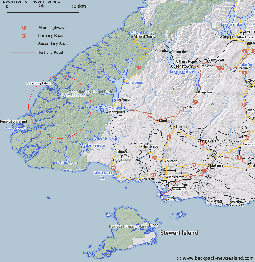
Map showing location of Mount Danae


LINZ description: Peak at head of Hall Arm, Doubtful Sound, 1495m. 3.2km South of Jaquiery Pass.
Latitude: -45.50266
Longitude: 167.032794
Northing: 4943861.9
Easting: 1133838.1
Land District: Southland
Feat Type: Hill


Scroll down to see a more detailed road map and below that a topographical map showing the location of Mount Danae. The road map has been supplied by openstreetmap and the topographical map of Mount Danae has been supplied by Land Information New Zealand (LINZ).

Yes you can use the top static map for you school/university project or personal website with a link back. Contact me for any commercial use.

Mount Danae Map New Zealand


New Zealand places in our database
[ A ] [ B ] [ C ] [ D ] [ E ] [ F ] [ G ] [ H ] [ I ] [ J ] [ K ] [ L ] [ M ] [ N ] [ O ] [ P ] [ Q ] [ R ] [ S ] [ T ] [ U ] [ V ] [ W ] [ X ] [ Y ] [ Z ]


Closest 20 Hills to Mount Danae

Mount Crowfoot ( 5.68km )   Mount Troup ( 7.53km )   Black Giants ( 7.63km )   Mount Noble ( 7.99km )   Commander Peak ( 8.04km )   Mount Thornton ( 9.14km )   Mount Nantes ( 9.23km )   Depth Peak ( 9.91km )   Mount Cusack ( 10.05km )   Mount Menteath ( 10.47km )   Mount Gladstone ( 10.67km )   Mount Horatio ( 10.75km )   Mount Wilmot ( 11.42km )   Mount Parker ( 11.47km )   Matterhorn ( 11.62km )   Heywood Peak ( 11.76km )   Koinga Peak ( 12km )   Mount Bain ( 12.42km )   Mount Pember ( 12.62km )   Turpentine ( 12.67km )   Aubrey Peak ( 12.75km )   Tussock Peak ( 13.46km )   Mount Plaisted ( 13.48km )   Mount Barber ( 14.07km )   Mount Mainwaring ( 14.11km )   Mount Fitchett ( 14.15km )   Mount Memphis ( 14.18km )   Pinnacle ( 14.6km )   Pahiri Peak ( 14.77km )   Mount Anderson ( 14.88km )   Mount Kellard ( 15.18km )   Tripod Hill ( 15.33km )   Mount McCorley ( 15.4km )   Mount George ( 15.98km )   Mount Thompson ( 16.08km )   McDonnell Peak ( 16.27km )   Mount Ward ( 16.41km )   Mount Watson ( 17.43km )   Mount Gray ( 17.67km )   Mount Grey ( 17.67km )