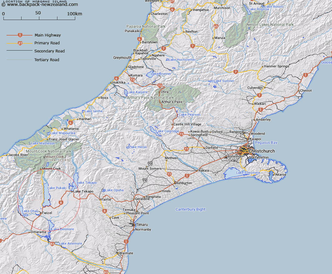
Map showing location of Morgans Island


LINZ description: Island in Lake Pukaki created by the raising of the lake. Trig W is situated on the Island.
Latitude: -44.100943
Longitude: 170.198869
Northing: 5113100
Easting: 1375800
Land District: Canterbury
Feat Type: Island


Scroll down to see a more detailed road map and below that a topographical map showing the location of Morgans Island. The road map has been supplied by openstreetmap and the topographical map of Morgans Island has been supplied by Land Information New Zealand (LINZ).

Yes you can use the top static map for you school/university project or personal website with a link back. Contact me for any commercial use.

Morgans Island Map New Zealand


New Zealand places in our database
[ A ] [ B ] [ C ] [ D ] [ E ] [ F ] [ G ] [ H ] [ I ] [ J ] [ K ] [ L ] [ M ] [ N ] [ O ] [ P ] [ Q ] [ R ] [ S ] [ T ] [ U ] [ V ] [ W ] [ X ] [ Y ] [ Z ]


Closest 20 Islands to Morgans Island

Jocks Island ( 25.42km )   Motuariki Island ( 31.77km )   Whanau Island ( 39.58km )   Goose Neck Island ( 42.58km )   Black Jacks Island ( 48.25km )   Turnagain Island ( 48.67km )   Junction Island ( 49.62km )   Silver Island ( 77.86km )   Otitia Rock ( 80.17km )   Hanata Island ( 80.2km )   Gull Island ( 93.72km )   Te Waipounamu ( 94.81km )   South Island ( 94.81km )   Hearntown Island ( 100.28km )   Rangitata Island ( 100.28km )   Stevensons Island ( 100.89km )   Pigeon Island ( 102.09km )   Harwich Island ( 102.09km )   Mou Waho ( 102.09km )   Bull Island ( 104.5km )   Crescent Island ( 106.57km )   Mou Tapu ( 106.57km )   Bignell Reef ( 107.78km )   Ruby Island ( 108.35km )   Taumaka Island ( 108.59km )   Open Bay Islands ( 108.97km )   Popotai Island ( 109.11km )   Sunbeam Island ( 111.4km )   The Island ( 112.05km )   Walkers Island ( 122.18km )   Stafford Rocks ( 133.54km )   Seal Rocks ( 134.52km )   Frenchies Island ( 147.38km )   Tui Island ( 148.76km )   Cashmere Island ( 149.32km )   Maukiekie Island ( 149.84km )   The Sugar Loaf ( 150.11km )   Barn Islands ( 151.42km )   Browne Island ( 155.53km )   Rakaia Island ( 160.04km )