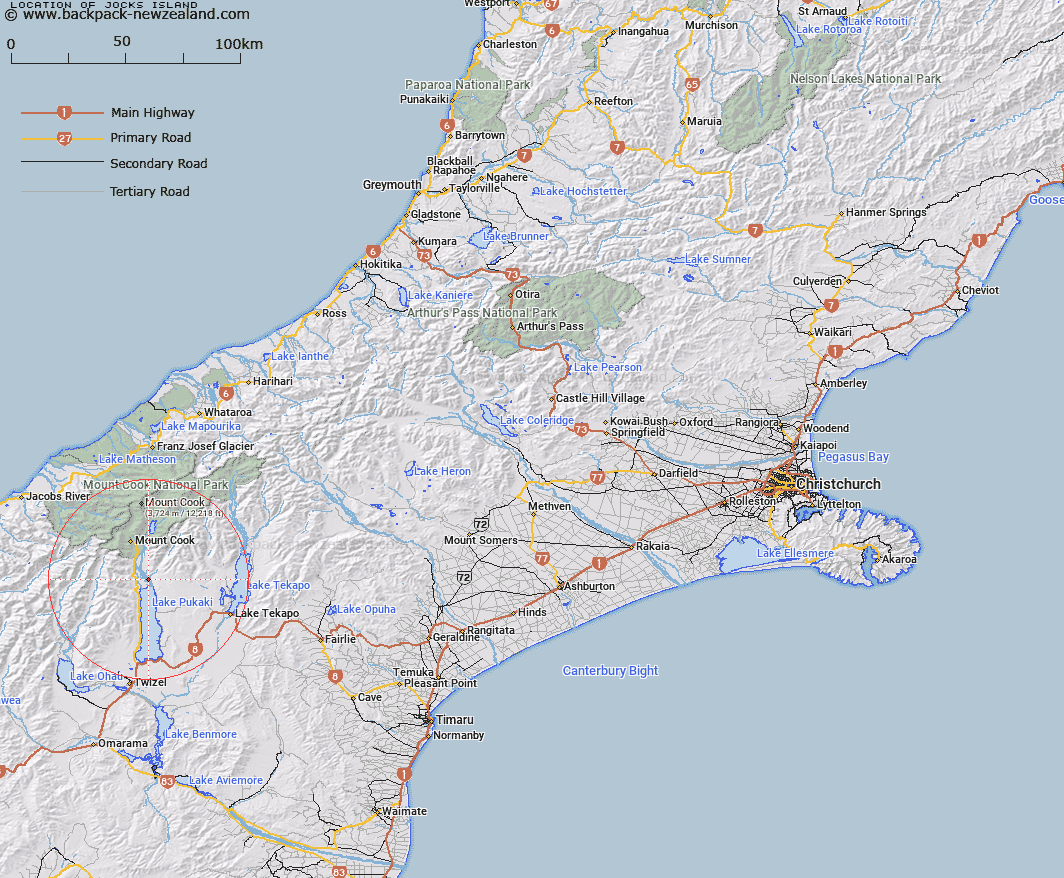
Map showing location of Jocks Island


LINZ description: A river flat of the Tasman River, on the eastern bank, below the junction with Jollie River. Once many hundreds of acres, now much smaller. Block I Jollie Survey District.
Latitude: -43.873419
Longitude: 170.16776
Northing: 5138286.4
Easting: 1372441.7
Land District: Canterbury
Feat Type: Island


Scroll down to see a more detailed road map and below that a topographical map showing the location of Jocks Island. The road map has been supplied by openstreetmap and the topographical map of Jocks Island has been supplied by Land Information New Zealand (LINZ).

Yes you can use the top static map for you school/university project or personal website with a link back. Contact me for any commercial use.

Jocks Island Map New Zealand


New Zealand places in our database
[ A ] [ B ] [ C ] [ D ] [ E ] [ F ] [ G ] [ H ] [ I ] [ J ] [ K ] [ L ] [ M ] [ N ] [ O ] [ P ] [ Q ] [ R ] [ S ] [ T ] [ U ] [ V ] [ W ] [ X ] [ Y ] [ Z ]


Closest 20 Islands to Jocks Island

Morgans Island ( 25.42km )   Motuariki Island ( 29.67km )   Hanata Island ( 63.84km )   Otitia Rock ( 63.93km )   Whanau Island ( 64.96km )   Goose Neck Island ( 67.95km )   Black Jacks Island ( 73.6km )   Turnagain Island ( 73.88km )   Junction Island ( 74.91km )   Te Waipounamu ( 82.95km )   South Island ( 82.95km )   Sunbeam Island ( 86.71km )   Gull Island ( 88.63km )   Silver Island ( 91.4km )   Bignell Reef ( 102.01km )   Taumaka Island ( 102.96km )   Open Bay Islands ( 103.38km )   Popotai Island ( 103.53km )   Rangitata Island ( 106.4km )   Hearntown Island ( 106.4km )   Walkers Island ( 106.93km )   Mou Waho ( 114.91km )   Harwich Island ( 114.91km )   Pigeon Island ( 114.91km )   Stevensons Island ( 114.97km )   Bull Island ( 119.42km )   Crescent Island ( 120.17km )   Mou Tapu ( 120.17km )   Ruby Island ( 123.48km )   Frenchies Island ( 125.05km )   The Island ( 125.5km )   Tui Island ( 126.47km )   Cashmere Island ( 127.03km )   Stafford Rocks ( 131.45km )   Seal Rocks ( 132.5km )   Hans Island ( 142.38km )   The Sugar Loaf ( 149.59km )   Barn Islands ( 150.98km )   Browne Island ( 156.15km )   Rakaia Island ( 160.53km )