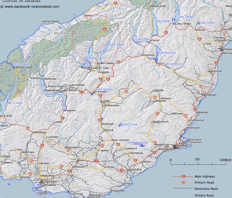
Map showing location of Makarora
LINZ description: Settlement along State Highway 6, 9.5km north of the northern shores of
Lake Wanaka, at the gateway to Mount Aspiring National Park. NZTopo50
BZ12-Makarora, GR 991 954.
Latitude: -44.232568
Longitude: 169.232569
Northing: 5095390.5
Easting: 1299125.9
Land District: Otago
Feat Type: Locality
Latitude: -44.232568
Longitude: 169.232569
Northing: 5095390.5
Easting: 1299125.9
Land District: Otago
Feat Type: Locality

Scroll down to see a more detailed road map and below that a topographical map showing the location of Makarora. The road map has been supplied by openstreetmap and the topographical map of Makarora has been supplied by Land Information New Zealand (LINZ).
Yes you can use the top static map for you school/university project or personal website with a link back. Contact me for any commercial use.
[ A ] [ B ] [ C ] [ D ] [ E ] [ F ] [ G ] [ H ] [ I ] [ J ] [ K ] [ L ] [ M ] [ N ] [ O ] [ P ] [ Q ] [ R ] [ S ] [ T ] [ U ] [ V ] [ W ] [ X ] [ Y ] [ Z ]