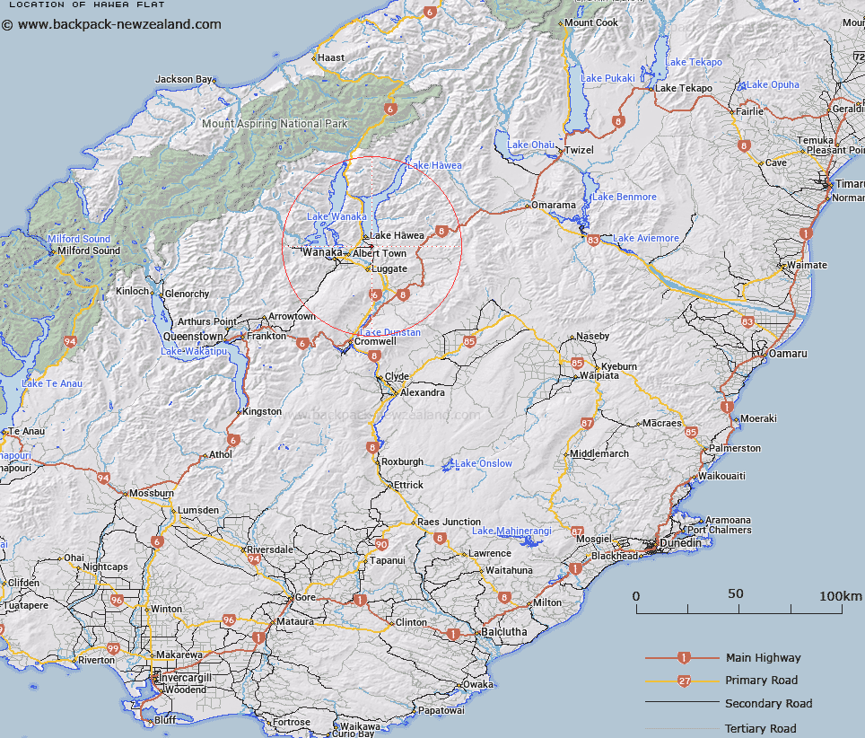
Map showing location of Hawea Flat


LINZ description: Small settlement located 5km south of Lake Hāwea. NZTopo50 map CA13-Lake Hawea, GR 057 490.
Latitude: -44.652175
Longitude: 169.288515
Northing: 5048983.8
Easting: 1305711.1
Land District: Otago
Feat Type: Locality


Scroll down to see a more detailed road map and below that a topographical map showing the location of Hawea Flat. The road map has been supplied by openstreetmap and the topographical map of Hawea Flat has been supplied by Land Information New Zealand (LINZ).

Yes you can use the top static map for you school/university project or personal website with a link back. Contact me for any commercial use.

Hawea Flat Map New Zealand


New Zealand places in our database
[ A ] [ B ] [ C ] [ D ] [ E ] [ F ] [ G ] [ H ] [ I ] [ J ] [ K ] [ L ] [ M ] [ N ] [ O ] [ P ] [ Q ] [ R ] [ S ] [ T ] [ U ] [ V ] [ W ] [ X ] [ Y ] [ Z ]


Closest 20 Localitys to Hawea Flat

Lower Hawea Flat ( 1.28km )   Lagoon Valley ( 3km )   Lake Hawea ( 4.99km )   Lake H?wea ( 4.99km )   Maungawera ( 5.46km )   Gladstone ( 6.75km )   Albert Town ( 8.37km )   Newcastle ( 8.37km )   Luggate ( 10.65km )   Mount Barker ( 12.34km )   Lindis Valley ( 20.67km )   Queensberry ( 21.67km )   Glendhu Bay ( 21.67km )   Tarras ( 22.78km )   Lindis Crossing ( 26.03km )   Ardgour ( 27.37km )   Minaret Bay ( 30.51km )   Bendigo ( 30.75km )   Mount Pisa ( 30.79km )   Logantown ( 32.23km )   Crippletown ( 32.83km )   Cardrona ( 33.89km )   Lowburn ( 39.61km )   Makarora Township ( 39.69km )   Macetown ( 44km )   Cromwell ( 44.13km )   Ripponvale ( 44.88km )   Cambrians ( 45.89km )   Matakanui ( 46.08km )   Kawarau Gorge ( 46.52km )   Drybread ( 46.75km )   Makarora ( 46.87km )   Saint Bathans ( 48km )   Waenga ( 48.4km )   Arrowtown ( 48.51km )   Gibbston ( 48.9km )   Bannockburn ( 49.68km )   Bullendale (The Reefs) ( 50.6km )   Skippers ( 52.4km )   Becks ( 52.51km )