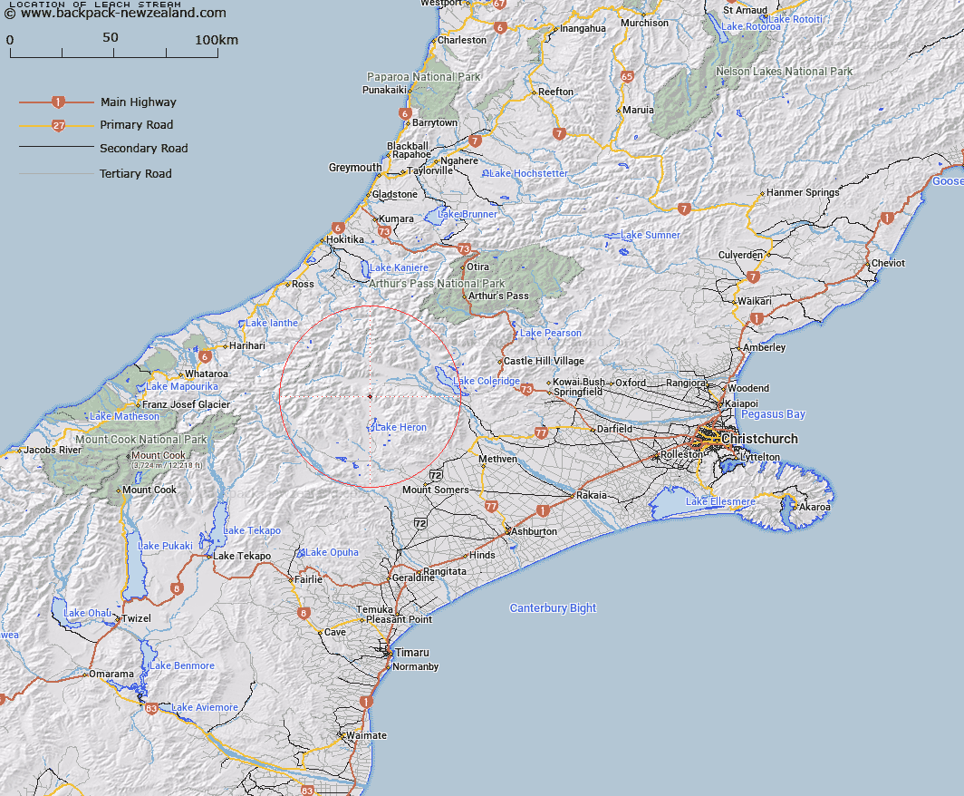
Map showing location of Leach Stream


LINZ description: Left bank tributary of Lake Stream rising 800m East of Trig. Z (Geodetic Code AN57), flowing South-westward and joining Lake Stream 1.3km South of Shaggy Hill [Trig. S (Geodetic Code AA8B)]. Block XV, Whitcombe Survey District.
Latitude: -43.35258
Longitude: 171.166043
Northing: 5198397.3
Easting: 1451373.2
Land District: Canterbury
Feat Type: Stream


Scroll down to see a more detailed road map and below that a topographical map showing the location of Leach Stream. The road map has been supplied by openstreetmap and the topographical map of Leach Stream has been supplied by Land Information New Zealand (LINZ).

Yes you can use the top static map for you school/university project or personal website with a link back. Contact me for any commercial use.

Leach Stream Map New Zealand


New Zealand places in our database
[ A ] [ B ] [ C ] [ D ] [ E ] [ F ] [ G ] [ H ] [ I ] [ J ] [ K ] [ L ] [ M ] [ N ] [ O ] [ P ] [ Q ] [ R ] [ S ] [ T ] [ U ] [ V ] [ W ] [ X ] [ Y ] [ Z ]


Closest 20 Streams to Leach Stream

Charlie Stream ( 2.78km )   Lake Stream ( 2.9km )   Nell Stream ( 3.93km )   Bush Creek ( 4.97km )   Shingly Creek ( 5.19km )   Ribbonwood Stream ( 6.04km )   Glenfalloch Stream ( 6.19km )   Lawsley Stream ( 6.57km )   Washbourne Creek ( 7.72km )   Smite River ( 8.59km )   Broad Creek ( 8.8km )   Station Creek ( 8.97km )   Big Fan Creek ( 9.02km )   Godley Stream ( 9.11km )   Polhill Stream ( 9.18km )   Jellicoe Stream ( 9.24km )   Rocky Spur Creek ( 9.42km )   Twin Creek ( 9.51km )   Strone Stream ( 9.68km )   Lochiel Stream ( 9.96km )   Cameron River ( 10.25km )   Lochaber Stream ( 10.33km )   Big Paddock Creek ( 11.53km )   Jagged Stream ( 11.66km )   Home Creek ( 11.73km )   Colonel Stream ( 11.9km )   Spean Stream ( 12.03km )   Dunbar Stream ( 12.77km )   Double Hill Stream ( 13.12km )   Triangle Stream ( 13.26km )   Petticoat Lane ( 13.38km )   Gerard Stream ( 13.53km )   Glenariffe Stream ( 13.62km )   Mathias River ( 13.95km )   Hut Stream ( 14.13km )   Totara Stream ( 14.17km )   Round Hill Creek ( 14.26km )   Bull Spur Stream ( 14.93km )   Mellish Stream ( 14.97km )   Swin River ( 15.03km )