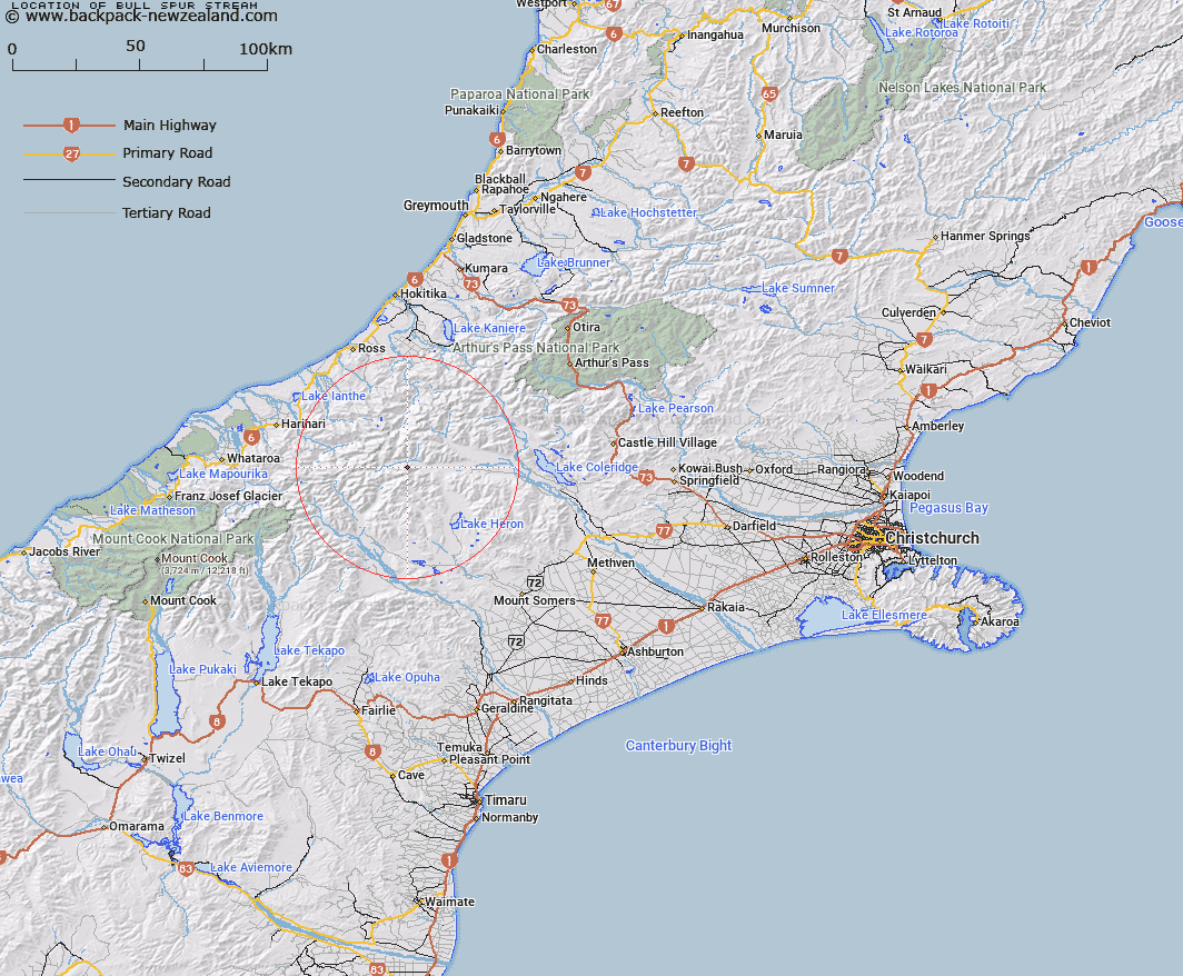
Map showing location of Bull Spur Stream


LINZ description: On south bank of the Rakaia River. Rises near Mt Medhurst and flows into Rakaia opposite Duncan Creek
Latitude: -43.287702
Longitude: 171.004425
Northing: 5205302
Easting: 1438102.9
Land District: Canterbury
Feat Type: Stream


Scroll down to see a more detailed road map and below that a topographical map showing the location of Bull Spur Stream. The road map has been supplied by openstreetmap and the topographical map of Bull Spur Stream has been supplied by Land Information New Zealand (LINZ).

Yes you can use the top static map for you school/university project or personal website with a link back. Contact me for any commercial use.

Bull Spur Stream Map New Zealand


New Zealand places in our database
[ A ] [ B ] [ C ] [ D ] [ E ] [ F ] [ G ] [ H ] [ I ] [ J ] [ K ] [ L ] [ M ] [ N ] [ O ] [ P ] [ Q ] [ R ] [ S ] [ T ] [ U ] [ V ] [ W ] [ X ] [ Y ] [ Z ]


Closest 20 Streams to Bull Spur Stream

Jagged Stream ( 3.44km )   Lauper Stream ( 4.55km )   Louper Stream ( 4.55km )   Duncan Creek ( 4.62km )   Reischek Stream ( 5.15km )   Cattle Stream ( 6.58km )   Totara Stream ( 6.91km )   Washbourne Creek ( 7.25km )   Jellicoe Stream ( 8.93km )   Dean Stream ( 9.25km )   Molar Stream ( 9.7km )   Moses Creek ( 9.71km )   Cap Creek ( 9.84km )   Lochaber Stream ( 9.88km )   Whitcombe River ( 10.05km )   Scandret Creek ( 10.07km )   Rocky Spur Creek ( 10.24km )   Spean Stream ( 10.65km )   Cairn Creek ( 10.78km )   Bush Creek ( 10.99km )   Snag Creek ( 11.04km )   Gateway Creek ( 11.27km )   Kirk Stream ( 11.75km )   Neave Creek ( 11.81km )   Twin Creek ( 11.91km )   Jerusalem Stream ( 12.3km )   Outlaw Creek ( 12.33km )   Hut Stream ( 12.34km )   Diorite Creek ( 12.52km )   Lochiel Stream ( 12.9km )   Jourdain Creek ( 12.97km )   South Mathias River ( 13.1km )   Wilkinson River ( 13.34km )   Broad Creek ( 13.65km )   Swift Water ( 13.79km )   Vane Stream ( 13.84km )   Sharpes Cascade ( 14.06km )   Cameron River ( 14.15km )   Evans River ( 14.18km )   Strone Stream ( 14.34km )