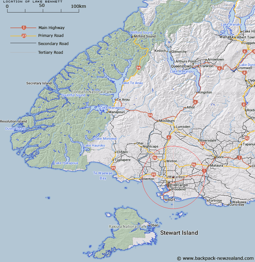
Map showing location of Lake Bennett


LINZ description: Small lake by Roslyn Bush, approximately 300mx60m, maximum depth 20ft.
Latitude: -46.329231
Longitude: 168.427802
Northing: 4859204.7
Easting: 1248086.9
Land District: Southland
Feat Type: Lake


Scroll down to see a more detailed road map and below that a topographical map showing the location of Lake Bennett. The road map has been supplied by openstreetmap and the topographical map of Lake Bennett has been supplied by Land Information New Zealand (LINZ).

Yes you can use the top static map for you school/university project or personal website with a link back. Contact me for any commercial use.

Lake Bennett Map New Zealand


New Zealand places in our database
[ A ] [ B ] [ C ] [ D ] [ E ] [ F ] [ G ] [ H ] [ I ] [ J ] [ K ] [ L ] [ M ] [ N ] [ O ] [ P ] [ Q ] [ R ] [ S ] [ T ] [ U ] [ V ] [ W ] [ X ] [ Y ] [ Z ]


Closest 20 Lakes to Lake Bennett

Lake Murihiku ( 15.11km )   Big Lagoon ( 19.64km )   Long White Lagoon ( 20.78km )   Waituna Lagoon ( 28.99km )   Lake Vincent ( 42.05km )   Lake George ( 44.3km )   Lake Charles ( 47.26km )   Lake Forest ( 48.18km )   Moana Putakitaki Lagoon ( 49.31km )   Te Awatuiau Lagoon ( 49.44km )   Waitokariro Lagoon ( 49.98km )   Lake Brunton ( 50.05km )   Tauatemaku Lagoon ( 51.04km )   Lake Cook ( 51.92km )   The Reservoir ( 60.06km )   Lake Calder ( 70.45km )   Lake Alexander ( 70.48km )   Lake Sheila ( 71.37km )   Double Lakes ( 71.99km )   Lake Wilkie ( 82.34km )   Lake Monowai ( 91.24km )   Monowai Lake ( 92.47km )   Catlins Lake ( 94.35km )   Lake Hauroto ( 95.82km )   Lake Hauroko ( 95.82km )   Green Lake ( 99.26km )   Gem Lake ( 99.34km )   Lake Rakatu ( 101.37km )   Lake Gow ( 101.7km )   Island Lake ( 102.37km )   Lake Thomas ( 102.42km )   Blue Lake ( 102.51km )   Lake Laura ( 103km )   Lake Scott ( 103.59km )   Skeleton Lakes ( 104.88km )   Misty Tarn ( 105.04km )   Lake Luxmore ( 105.89km )   Lake Jaquiery ( 106.78km )   Lake Poteriteri ( 106.84km )   Lake Tuakitoto ( 107.86km )