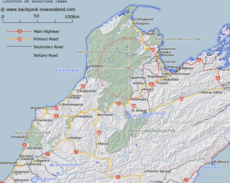
Map showing location of Ironstone Creek
LINZ description: Left Bank tributary of Baton River rising 1.4km North of Loveridge Peak in the Arthur Range, flowing generally southward and joining Baton River 2km upstream of Loveridge Creek. Block XIII Mount Arthur and Block I Wangapeka Survey Districts.
Latitude: -41.270334
Longitude: 172.62162
Northing: 5431163.5
Easting: 1568308
Land District: Nelson
Feat Type: Stream
Latitude: -41.270334
Longitude: 172.62162
Northing: 5431163.5
Easting: 1568308
Land District: Nelson
Feat Type: Stream

Scroll down to see a more detailed road map and below that a topographical map showing the location of Ironstone Creek. The road map has been supplied by openstreetmap and the topographical map of Ironstone Creek has been supplied by Land Information New Zealand (LINZ).
Yes you can use the top static map for you school/university project or personal website with a link back. Contact me for any commercial use.
[ A ] [ B ] [ C ] [ D ] [ E ] [ F ] [ G ] [ H ] [ I ] [ J ] [ K ] [ L ] [ M ] [ N ] [ O ] [ P ] [ Q ] [ R ] [ S ] [ T ] [ U ] [ V ] [ W ] [ X ] [ Y ] [ Z ]