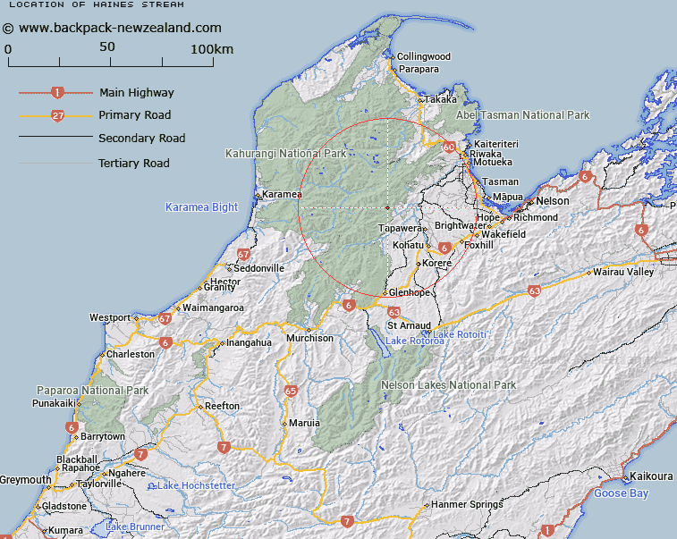
Map showing location of Haines Stream
LINZ description: Left bank tributary of Baton River rising 700m South South-west of Trig. O (Geodetic Code A68K) on Paddy Ridge flowing southward to join Baton River 3.4km upstream of Ellis River. Block II Wangapeka Survey District.
Latitude: -41.295971
Longitude: 172.664481
Northing: 5428332.3
Easting: 1571909
Land District: Nelson
Feat Type: Stream
Latitude: -41.295971
Longitude: 172.664481
Northing: 5428332.3
Easting: 1571909
Land District: Nelson
Feat Type: Stream

Scroll down to see a more detailed road map and below that a topographical map showing the location of Haines Stream. The road map has been supplied by openstreetmap and the topographical map of Haines Stream has been supplied by Land Information New Zealand (LINZ).
Yes you can use the top static map for you school/university project or personal website with a link back. Contact me for any commercial use.
[ A ] [ B ] [ C ] [ D ] [ E ] [ F ] [ G ] [ H ] [ I ] [ J ] [ K ] [ L ] [ M ] [ N ] [ O ] [ P ] [ Q ] [ R ] [ S ] [ T ] [ U ] [ V ] [ W ] [ X ] [ Y ] [ Z ]