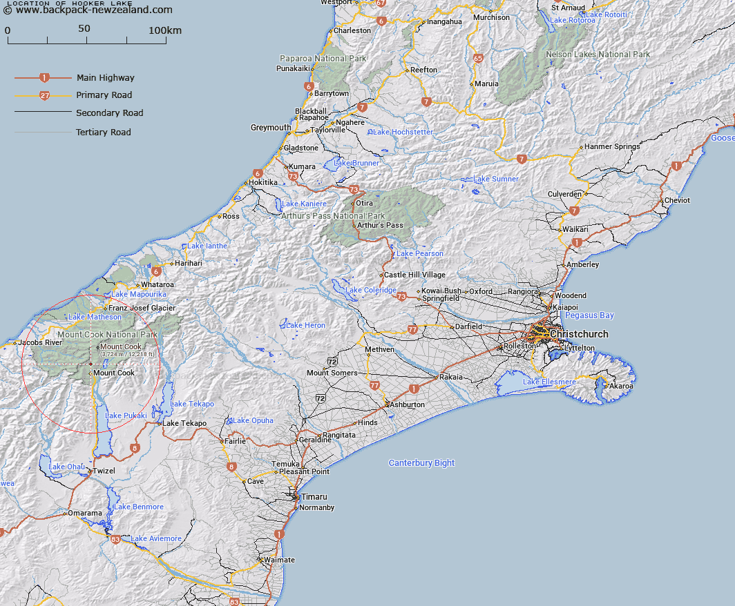
Map showing location of Hooker Lake


LINZ description: Lake, a new feature formed at the base of the Hooker Glacier near Aoraki/Mount Cook.
Latitude: -43.683533
Longitude: 170.104242
Northing: 5159200
Easting: 1366600
Land District: Canterbury
Feat Type: Lake


Scroll down to see a more detailed road map and below that a topographical map showing the location of Hooker Lake. The road map has been supplied by openstreetmap and the topographical map of Hooker Lake has been supplied by Land Information New Zealand (LINZ).

Yes you can use the top static map for you school/university project or personal website with a link back. Contact me for any commercial use.

Hooker Lake Map New Zealand


New Zealand places in our database
[ A ] [ B ] [ C ] [ D ] [ E ] [ F ] [ G ] [ H ] [ I ] [ J ] [ K ] [ L ] [ M ] [ N ] [ O ] [ P ] [ Q ] [ R ] [ S ] [ T ] [ U ] [ V ] [ W ] [ X ] [ Y ] [ Z ]


Closest 20 Lakes to Hooker Lake

Sealy Tarns ( 4.11km )   Blue Lakes ( 4.98km )   Tasman Lake ( 6.4km )   Red Tarns ( 7.14km )   Saddle Lake ( 16.78km )   Acland Lagoon ( 16.88km )   Lake Roto Te Koeti ( 27.81km )   Lake Rototekoiti ( 27.81km )   Lake Matheson ( 29.62km )   Lake Mueller ( 29.7km )   Lake Gault ( 29.73km )   Peters Pool ( 29.83km )   Lake Gibb ( 30.92km )   Lake Gibbs ( 30.92km )   Lake Wombat ( 31.58km )   Lake Lyttle ( 31.6km )   Lake Pukaki ( 31.68km )   Fred's Tarn ( 32.76km )   Freds Tarn ( 32.76km )   Lake Barrowman ( 33.98km )   Cluster Tarns ( 34.37km )   Boltons Gully Lagoon ( 34.4km )   Glenmore Tarns ( 34.44km )   Tui Tarn ( 34.56km )   Stony Tarn ( 34.7km )   Hartley Tarn ( 34.8km )   Otoko Lake ( 34.93km )   Braemar Kettleholes ( 34.98km )   Sunday Tarn ( 35.28km )   Boundary Tarns ( 35.38km )   Grebe Tarn ( 35.45km )   Swan Lagoon ( 35.99km )   Forks Lagoon ( 36.57km )   Lake Pratt ( 37.29km )   The Black Hole ( 37.37km )   Rapuwai Lagoon ( 37.42km )   Lake Murray ( 38.19km )   Lake Kini ( 39.67km )   Lake Alexandrina ( 40.03km )   Lake McGregor ( 40.69km )