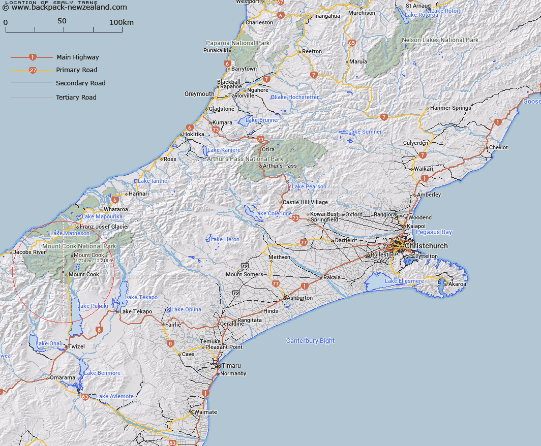
Map showing location of Sealy Tarns


LINZ description: Small mountain lake features at north end of Sealy Range in Mount Cook National Park.
Latitude: -43.71353
Longitude: 170.074334
Northing: 5155783.7
Easting: 1364307
Land District: Canterbury
Feat Type: Lake


Scroll down to see a more detailed road map and below that a topographical map showing the location of Sealy Tarns. The road map has been supplied by openstreetmap and the topographical map of Sealy Tarns has been supplied by Land Information New Zealand (LINZ).

Yes you can use the top static map for you school/university project or personal website with a link back. Contact me for any commercial use.

Sealy Tarns Map New Zealand


New Zealand places in our database
[ A ] [ B ] [ C ] [ D ] [ E ] [ F ] [ G ] [ H ] [ I ] [ J ] [ K ] [ L ] [ M ] [ N ] [ O ] [ P ] [ Q ] [ R ] [ S ] [ T ] [ U ] [ V ] [ W ] [ X ] [ Y ] [ Z ]


Closest 20 Lakes to Sealy Tarns

Hooker Lake ( 4.11km )   Red Tarns ( 4.3km )   Blue Lakes ( 7.56km )   Tasman Lake ( 8.65km )   Acland Lagoon ( 13.85km )   Saddle Lake ( 19.16km )   Lake Rototekoiti ( 26.28km )   Lake Roto Te Koeti ( 26.28km )   Lake Pukaki ( 28.9km )   Otoko Lake ( 31.4km )   Fred's Tarn ( 31.87km )   Freds Tarn ( 31.87km )   Lake Matheson ( 31.96km )   Boltons Gully Lagoon ( 32.25km )   Lake Gault ( 32.29km )   Braemar Kettleholes ( 32.52km )   Lake Mueller ( 32.66km )   Peters Pool ( 33.59km )   Lake Gibb ( 33.75km )   Lake Gibbs ( 33.75km )   Lake Lyttle ( 33.96km )   Cluster Tarns ( 33.98km )   Glenmore Tarns ( 34.23km )   Swan Lagoon ( 34.24km )   Tui Tarn ( 34.73km )   Hartley Tarn ( 34.78km )   Stony Tarn ( 34.79km )   Boundary Tarns ( 34.85km )   Sunday Tarn ( 34.92km )   The Black Hole ( 35.11km )   Grebe Tarn ( 35.2km )   Lake Wombat ( 35.31km )   Forks Lagoon ( 35.61km )   Rapuwai Lagoon ( 38.03km )   Lake Barrowman ( 38.04km )   Lake Murray ( 38.1km )   Lake Kini ( 38.25km )   Lake Alexandrina ( 39.47km )   Lake McGregor ( 40.32km )   Lake Pratt ( 40.98km )