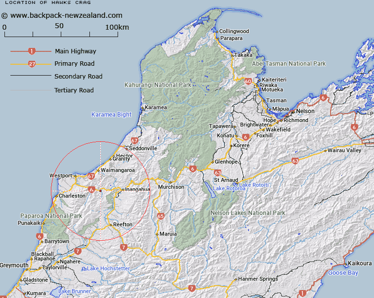
Map showing location of Hawks Crag


LINZ description: Rock feature on the main highway, opposite Dee Point, in the Lower Buller Gorge. Ohika Survey District. Feature shown on: Feature shown on: NZMS260 K29 Edition 2 1994; NZTopo50-BS21 987644
Latitude: -41.864619
Longitude: 171.778793
Northing: 5364533.9
Easting: 1498647.6
Land District: Nelson
Feat Type: Hill


Scroll down to see a more detailed road map and below that a topographical map showing the location of Hawks Crag. The road map has been supplied by openstreetmap and the topographical map of Hawks Crag has been supplied by Land Information New Zealand (LINZ).

Yes you can use the top static map for you school/university project or personal website with a link back. Contact me for any commercial use.

Hawks Crag Map New Zealand


New Zealand places in our database
[ A ] [ B ] [ C ] [ D ] [ E ] [ F ] [ G ] [ H ] [ I ] [ J ] [ K ] [ L ] [ M ] [ N ] [ O ] [ P ] [ Q ] [ R ] [ S ] [ T ] [ U ] [ V ] [ W ] [ X ] [ Y ] [ Z ]


Closest 20 Hills to Hawks Crag

Hawks Crag ( 0km )   Jacobsen Mount ( 1.53km )   Mount Cassin ( 2.79km )   Mount Burley ( 3.13km )   Sinclair Castle ( 5.14km )   Berlins Bluff ( 5.87km )   Mount Galileo ( 9.84km )   Mount Rochfort ( 10.07km )   Mount Waller ( 10.29km )   Mount William ( 11.38km )   Mount Courtney ( 11.98km )   Buckland Peaks ( 12.1km )   Rosemount ( 12.56km )   Needle ( 13.14km )   Mount Copernicus ( 15.34km )   Mount Kelvin ( 15.59km )   Mount Lavoisier ( 17.14km )   Mount Euclid ( 18.51km )   Mount Frederick ( 18.65km )   Mount Rutherford ( 19.24km )   Mount Fleming ( 19.26km )   Mount Uriah ( 20.48km )   Mount Steele ( 20.72km )   Mount Augustus ( 21.94km )   Mount Stevenson ( 21.94km )   Mount Einstein ( 22.02km )   Giants Grave ( 22.32km )   Mount Micawber ( 22.62km )   Boundary Peak ( 22.82km )   Mount Mendel ( 23.21km )   Mount Pasteur ( 23.25km )   Isolated Hill ( 23.78km )   Mount Curtis ( 23.83km )   Costello Hill ( 24.17km )   Mount Curie ( 24.37km )   Mount Wynn ( 24.48km )   Sugar Loaf ( 24.58km )   Mount Raoulia ( 25.04km )   Bourkes Rock ( 25.09km )   Mount Epping ( 25.33km )