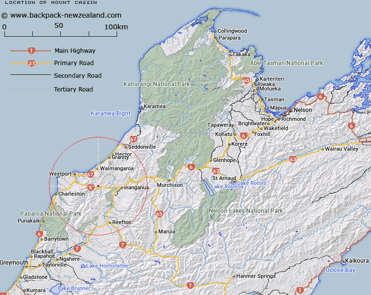
Map showing location of Mount Cassin


LINZ description: Peak (706m) with Trig. C (Geodetic Code A5Q8) on summit in the Lower Buller Gorge. 2.75km North North-west of Dee Point. Block IV Ohika Survey District.
Latitude: -41.84121
Longitude: 171.76663
Northing: 5367118.6
Easting: 1497600.8
Land District: Nelson
Feat Type: Hill


Scroll down to see a more detailed road map and below that a topographical map showing the location of Mount Cassin. The road map has been supplied by openstreetmap and the topographical map of Mount Cassin has been supplied by Land Information New Zealand (LINZ).

Yes you can use the top static map for you school/university project or personal website with a link back. Contact me for any commercial use.

Mount Cassin Map New Zealand


New Zealand places in our database
[ A ] [ B ] [ C ] [ D ] [ E ] [ F ] [ G ] [ H ] [ I ] [ J ] [ K ] [ L ] [ M ] [ N ] [ O ] [ P ] [ Q ] [ R ] [ S ] [ T ] [ U ] [ V ] [ W ] [ X ] [ Y ] [ Z ]


Closest 20 Hills to Mount Cassin

Hawks Crag ( 2.79km )   Jacobsen Mount ( 2.93km )   Sinclair Castle ( 3.39km )   Mount Burley ( 5.47km )   Mount Rochfort ( 7.28km )   Berlins Bluff ( 8.37km )   Mount William ( 9.48km )   Mount Waller ( 10.04km )   Mount Galileo ( 11.76km )   Buckland Peaks ( 11.99km )   Mount Courtney ( 12.32km )   Needle ( 13.36km )   Rosemount ( 13.58km )   Mount Kelvin ( 16.14km )   Mount Frederick ( 16.57km )   Mount Lavoisier ( 17.81km )   Mount Copernicus ( 17.82km )   Mount Euclid ( 19.38km )   Mount Augustus ( 19.83km )   Mount Fleming ( 19.91km )   Mount Rutherford ( 20.37km )   Giants Grave ( 21.47km )   Mount Uriah ( 22.23km )   Isolated Hill ( 22.44km )   Mount Steele ( 23.1km )   Mount Einstein ( 23.32km )   Costello Hill ( 23.51km )   Boundary Peak ( 23.79km )   Mount Stevenson ( 24.11km )   Mount Stockton ( 24.23km )   Mount Micawber ( 24.37km )   Mount Pasteur ( 24.49km )   Mount Mendel ( 24.55km )   Mount Berners ( 24.9km )   Mount Curtis ( 25.36km )   Mount Curie ( 25.77km )   Mount Lyell ( 26.47km )   Mount Wynn ( 26.51km )   Mount Faraday ( 26.9km )   Parsons Hill ( 26.96km )