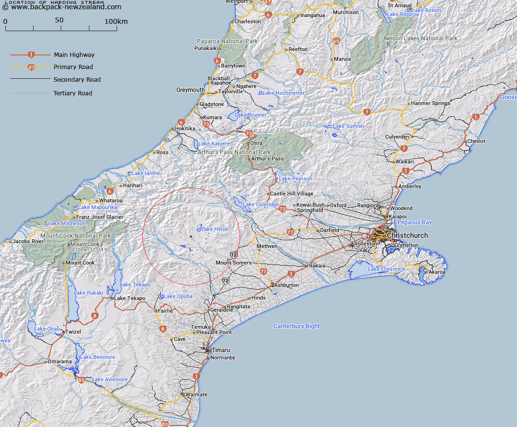
Map showing location of Harding Stream


LINZ description: Left bank tributary of South Branch Ashburton River rising 2km South-east of Trig. C (Geodetic Code AN5P), flowing generally southward, and joining South Branch Ashburton River 2.75km North of Dogs Hill [Trig. H (Geodetic Code ANE3)]. Blocks XIV and XV, Heron Survey District.
Latitude: -43.532284
Longitude: 171.109289
Northing: 5178336.7
Easting: 1447226.7
Land District: Canterbury
Feat Type: Stream


Scroll down to see a more detailed road map and below that a topographical map showing the location of Harding Stream. The road map has been supplied by openstreetmap and the topographical map of Harding Stream has been supplied by Land Information New Zealand (LINZ).

Yes you can use the top static map for you school/university project or personal website with a link back. Contact me for any commercial use.

Harding Stream Map New Zealand


New Zealand places in our database
[ A ] [ B ] [ C ] [ D ] [ E ] [ F ] [ G ] [ H ] [ I ] [ J ] [ K ] [ L ] [ M ] [ N ] [ O ] [ P ] [ Q ] [ R ] [ S ] [ T ] [ U ] [ V ] [ W ] [ X ] [ Y ] [ Z ]


Closest 20 Streams to Harding Stream

Harding Stream ( 0km )   Sparrow Hawk Stream ( 4.16km )   Clent Hills Stream ( 5.03km )   Olliver Stream ( 5.09km )   Paddle Hill Creek ( 5.24km )   Johnstone Stream ( 5.49km )   Red Moutain Stream ( 5.72km )   Gentleman Smith Stream ( 6.06km )   Triangle Stream ( 7.27km )   Jacobs Stream ( 7.35km )   Kenneth Creek ( 7.56km )   Emily Stream ( 7.65km )   Dunbar Stream ( 7.99km )   Haast Stream ( 8.45km )   Craddock Stream ( 8.57km )   Cradock Stream ( 8.57km )   Swin River ( 9.11km )   Potato Stream ( 9.97km )   Lambies Stream ( 10.51km )   Emma Stream ( 11.14km )   Mellish Stream ( 11.16km )   Swin River South Branch ( 11.78km )   Polhill Stream ( 11.81km )   Stour River West Branch ( 12.13km )   Markhams Stream ( 12.14km )   Whisky Stream ( 12.33km )   Finger Stream ( 12.33km )   Swin River North Branch ( 12.43km )   Balmacaan Stream ( 12.83km )   Powerhouse Stream ( 12.83km )   Waterfall Stream ( 13.25km )   Stour River East Branch ( 13.53km )   Stumpy Stream ( 13.74km )   Denny Stream ( 13.89km )   Black Stream ( 13.93km )   Lawsley Stream ( 13.98km )   Home Creek ( 13.98km )   Strone Stream ( 14.26km )   Cameron River ( 14.37km )   Maxwell Stream ( 14.53km )