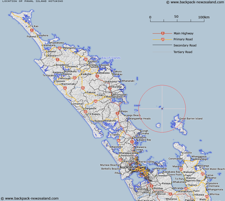
Map showing location of Fanal Island (Motukino)


LINZ description: Located offshore from the northeast coast of the North Island, approximately 23km northwest of Great Barrier Island (Aotea Island) and approximately 57km due east of Bream Bay. The largest island in the Mokohinau Islands group at approximately 1.5km long.
Latitude: -35.940154
Longitude: 175.146456
Northing: 6020560.1
Easting: 1793615.3
Land District: North Auckland
Feat Type: Island


Scroll down to see a more detailed road map and below that a topographical map showing the location of Fanal Island (Motukino). The road map has been supplied by openstreetmap and the topographical map of Fanal Island (Motukino) has been supplied by Land Information New Zealand (LINZ).

Yes you can use the top static map for you school/university project or personal website with a link back. Contact me for any commercial use.

Fanal Island (Motukino) Map New Zealand


New Zealand places in our database
[ A ] [ B ] [ C ] [ D ] [ E ] [ F ] [ G ] [ H ] [ I ] [ J ] [ K ] [ L ] [ M ] [ N ] [ O ] [ P ] [ Q ] [ R ] [ S ] [ T ] [ U ] [ V ] [ W ] [ X ] [ Y ] [ Z ]


Closest 20 Islands to Fanal Island (Motukino)

Fanal Island (Motukino) ( 0km )   Navire Rock ( 2.01km )   Sphinx Rocks ( 4.21km )   Lizard Isle ( 4.39km )   Burgess Island (Pokohinu) ( 4.88km )   Hokoromea Island ( 4.95km )   Mokohinau Islands ( 5.17km )   Flax Islands ( 5.26km )   Motupapa Island ( 5.26km )   Atihau Island ( 5.32km )   Bird Rock ( 5.42km )   Simpson Rock ( 7.89km )   Groper Island (Tatapihi) ( 9.3km )   Aiguilles Island ( 25.69km )   The Queen ( 25.9km )   Bird Rocks ( 26.25km )   Sugarloaf ( 26.32km )   Lots Wife ( 26.45km )   Okokewa Island (Green Island) ( 26.77km )   Rabbit Island ( 27.5km )   Oyster Island ( 27.62km )   Motuhaku Island ( 28.07km )   Mihi Rock ( 28.28km )   Nelson Island (Peter Island) ( 28.6km )   Wood Island ( 28.97km )   Lion Rock ( 29.7km )   Te Hauturu-o-Toi / Little Barrier Island ( 29.73km )   Little Barrier (Hauturu Island) ( 29.73km )   Hauturu/Little Barrier Island ( 29.73km )   Moturako Island ( 29.86km )   Great Barrier Island (Aotea Island) ( 29.86km )   Kaikoura Island (Selwyn Island) ( 30.26km )   Grey Group Islands ( 30.78km )   Quoin Island (Graves Island) ( 31.91km )   Opakau Island ( 32.18km )   Motutaiko Island ( 33.37km )   Broken Islands (Pig Islands) ( 33.68km )   Papakuri Island ( 33.78km )   Coppermine Island ( 34.2km )   Rangiahua Island (Flat Island) ( 34.24km )