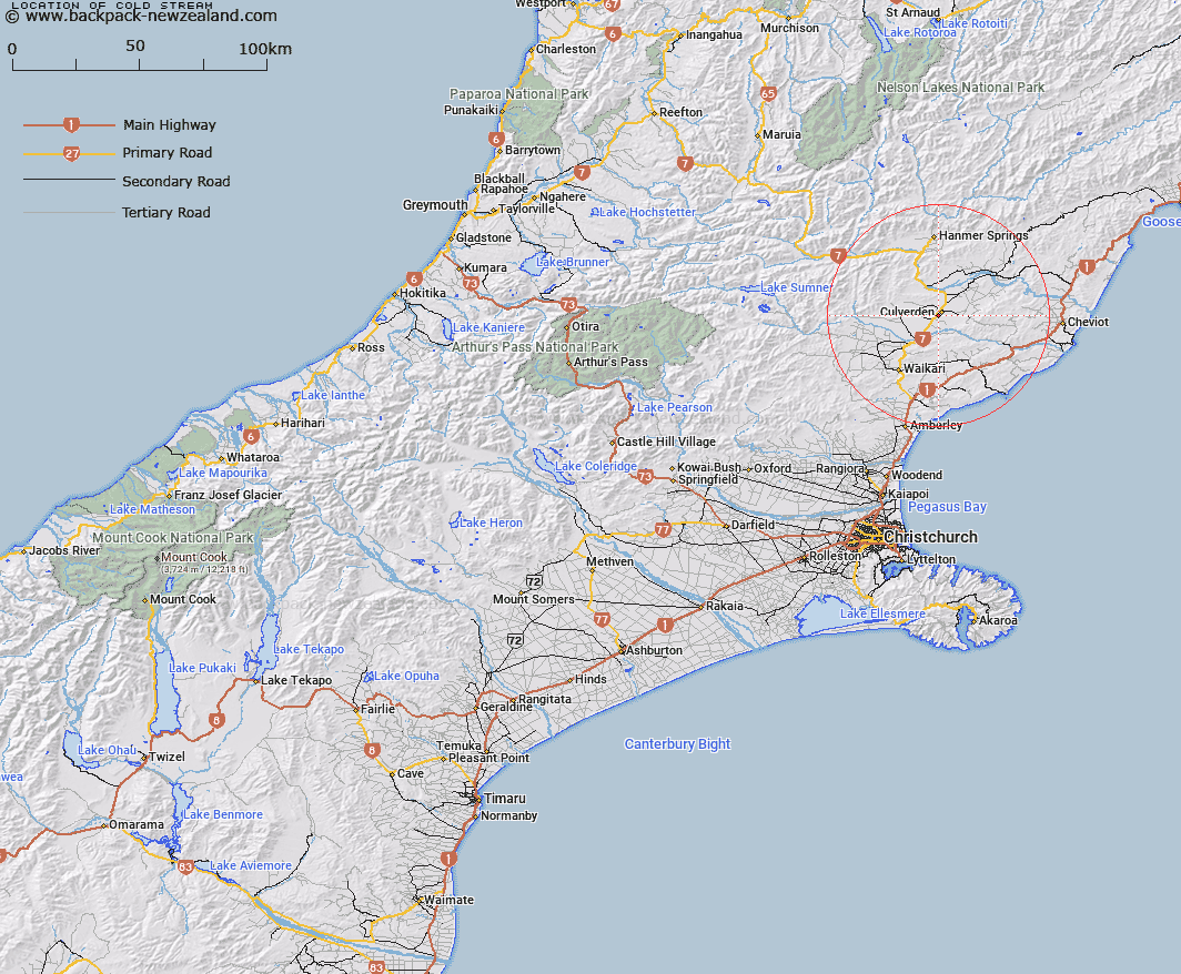
Map showing location of Cold Stream


LINZ description: Feature shown on: NZMS260 N33 Edition 1 1991
Latitude: -42.788444
Longitude: 172.844194
Northing: 5262665.9
Easting: 1587257.1
Land District: Canterbury
Feat Type: Stream


Scroll down to see a more detailed road map and below that a topographical map showing the location of Cold Stream. The road map has been supplied by openstreetmap and the topographical map of Cold Stream has been supplied by Land Information New Zealand (LINZ).

Yes you can use the top static map for you school/university project or personal website with a link back. Contact me for any commercial use.
Cold Stream Map New Zealand


New Zealand places in our database
[ A ] [ B ] [ C ] [ D ] [ E ] [ F ] [ G ] [ H ] [ I ] [ J ] [ K ] [ L ] [ M ] [ N ] [ O ] [ P ] [ Q ] [ R ] [ S ] [ T ] [ U ] [ V ] [ W ] [ X ] [ Y ] [ Z ]


Closest 20 Streams to Cold Stream

School Creek ( 1.48km )   Dry Stream ( 3.38km )   Pahau River ( 9.63km )   Black Birch Stream ( 12.17km )   Countess Stream ( 12.38km )   Darkest Africa Stream ( 12.48km )   Ramatama Stream ( 13.64km )   Scargill Creek ( 13.96km )   Stinking Stream ( 13.99km )   Cascade Stream ( 14.82km )   Leslie Stream ( 15.1km )   Mangatikera Stream ( 15.89km )   Karaka Stream ( 16.19km )   Kaiwara River ( 16.21km )   Browns stream ( 16.27km )   Glen Jon Stream ( 16.78km )   Awatui Stream ( 16.89km )   Rapu Stream ( 17km )   Waikari River ( 17.03km )   Twenty One Mile Stream ( 17.83km )   Pass Stream ( 18.21km )   Blind Stream ( 18.86km )   Te Kooti Stream ( 18.99km )   Sweetwater Stream ( 19.36km )   Broom Stream ( 19.62km )   Camp Creek ( 19.93km )   Dove River ( 20.19km )   Glenallan Stream ( 20.23km )   Ribbon Stream ( 20.82km )   Omihi Stream ( 20.9km )   Silver Stream ( 21.16km )   Cobbolds Creek ( 22.41km )   Home Stream ( 22.82km )   Black Creek ( 22.87km )   Tipapa Stream ( 22.92km )   Spurtelton Creek ( 23.05km )   Glencoe River ( 23.17km )   Home Creek ( 23.22km )   Greenstone Stream ( 23.49km )   Ship Spur Stream ( 23.49km )