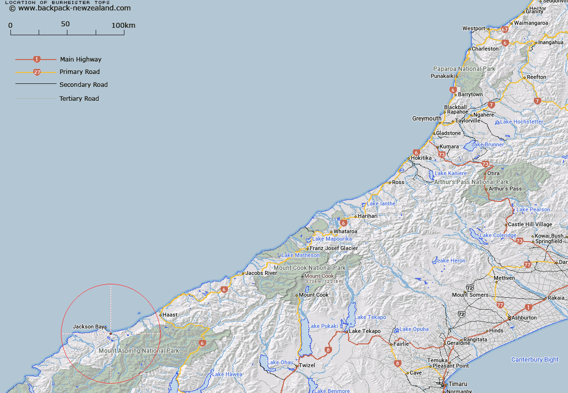
Map showing location of Burmeister Tops


LINZ description: Range of hills running in a south easterly direction behind Jackson Bay
Latitude: -44.018134
Longitude: 168.655876
Northing: 5116931.6
Easting: 1251808
Land District: Westland
Feat Type: Range


Scroll down to see a more detailed road map and below that a topographical map showing the location of Burmeister Tops. The road map has been supplied by openstreetmap and the topographical map of Burmeister Tops has been supplied by Land Information New Zealand (LINZ).

Yes you can use the top static map for you school/university project or personal website with a link back. Contact me for any commercial use.

Burmeister Tops Map New Zealand


New Zealand places in our database
[ A ] [ B ] [ C ] [ D ] [ E ] [ F ] [ G ] [ H ] [ I ] [ J ] [ K ] [ L ] [ M ] [ N ] [ O ] [ P ] [ Q ] [ R ] [ S ] [ T ] [ U ] [ V ] [ W ] [ X ] [ Y ] [ Z ]


Closest 20 Ranges to Burmeister Tops

Stafford Range ( 7.41km )   McARTHUR TOPS ( 8.46km )   Thomson Range ( 12.28km )   Selborne Range ( 21.24km )   Hope Blue River Range ( 21.95km )   Drake Range ( 25.04km )   Olivine Range ( 25.11km )   Commissioner Range ( 26.59km )   Macpherson Heights ( 26.71km )   Browning Range ( 27.55km )   Haast Range ( 35.84km )   Marks Range ( 36.65km )   Mark Range ( 36.65km )   Glissa Range ( 36.78km )   Waipara Range ( 37.48km )   Red Hills Range ( 41.09km )   Malcolm Range ( 42.58km )   Turret Peaks ( 44.42km )   Mataketake Range ( 46.46km )   McKenzie Range ( 47.04km )   Little Red Hill Range ( 47.33km )   Five Fingers Range ( 47.43km )   Thomas Range ( 48.76km )   Snowdrift Range ( 49.09km )   Minaret Peaks ( 53.54km )   McKerrow Range ( 55.17km )   Barrier Range ( 58.53km )   Young Range ( 60.09km )   Sara Hills ( 61.65km )   Forbes Mountains ( 61.7km )   Collie Range ( 63.14km )   Buchanan Peaks ( 65.06km )   The Four Peaks ( 66.2km )   Byrniera Range ( 67.86km )   Bryneira Range ( 67.86km )   Cosmos Peaks ( 67.93km )   Skippers Range ( 68.15km )   Centaur Peaks ( 68.87km )   May Hills ( 69.67km )   Bealey Range ( 69.78km )