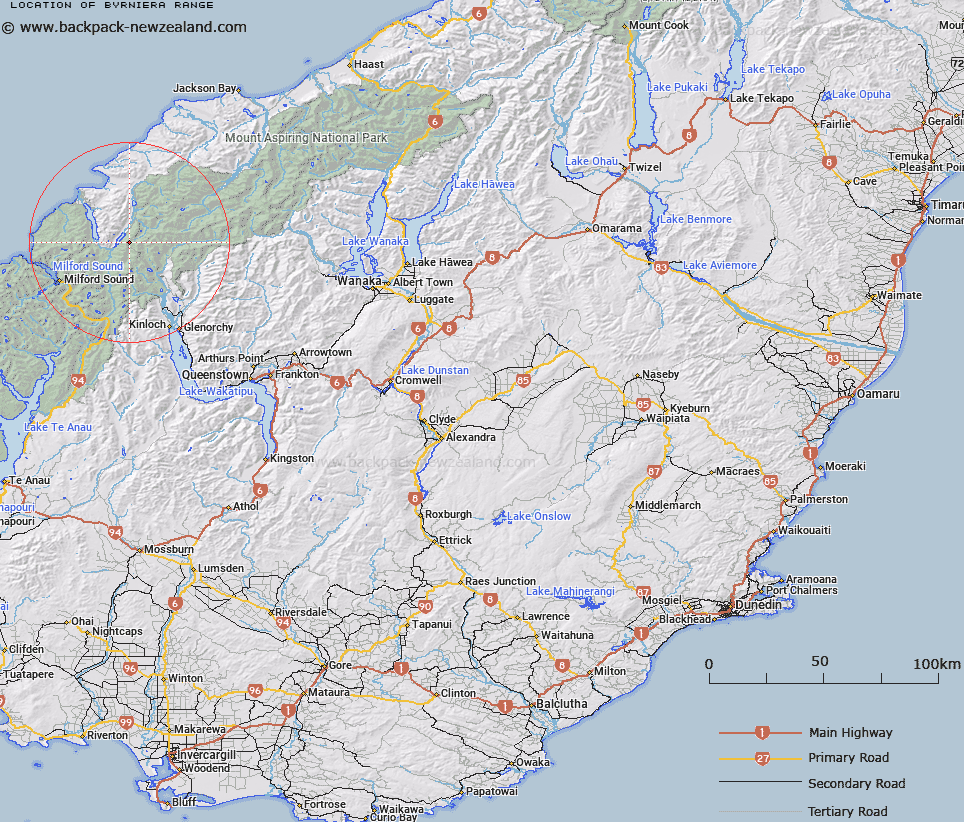
Map showing location of Byrniera Range


LINZ description: Bounded by Hollyford, Pyke, and Olivine Rivers, and Hidden Falls Creek
Latitude: -44.532386
Longitude: 168.19684
Northing: 5057761.6
Easting: 1218363.4
Land District: Otago
Feat Type: Range


Scroll down to see a more detailed road map and below that a topographical map showing the location of Byrniera Range. The road map has been supplied by openstreetmap and the topographical map of Byrniera Range has been supplied by Land Information New Zealand (LINZ).

Yes you can use the top static map for you school/university project or personal website with a link back. Contact me for any commercial use.

Byrniera Range Map New Zealand


New Zealand places in our database
[ A ] [ B ] [ C ] [ D ] [ E ] [ F ] [ G ] [ H ] [ I ] [ J ] [ K ] [ L ] [ M ] [ N ] [ O ] [ P ] [ Q ] [ R ] [ S ] [ T ] [ U ] [ V ] [ W ] [ X ] [ Y ] [ Z ]


Closest 20 Ranges to Byrniera Range

Cosmos Peaks ( 8.68km )   Skippers Range ( 8.93km )   Barrier Range ( 11.95km )   Serpentine Range ( 18.84km )   Forbes Mountains ( 20.25km )   Darran Mountains ( 20.25km )   Little Red Hill Range ( 21.52km )   Sara Hills ( 21.79km )   Humboldt Mountains ( 22.65km )   Five Fingers Range ( 22.84km )   May Hills ( 23.15km )   Red Hills Range ( 27km )   Ailsa Mountains ( 27.41km )   The Palisades ( 27.81km )   Snowdrift Range ( 29.15km )   McKenzie Range ( 29.2km )   Sheerdown Hills ( 30.44km )   Centaur Peaks ( 31.64km )   Llawrenny Peaks ( 33.62km )   Te Puhituia ( 33.62km )   Richardson Mountains ( 33.97km )   Malcolm Range ( 35.08km )   Wick Mountains ( 37.61km )   Waipara Range ( 38.82km )   Earl Mountains ( 42.03km )   Livingstone Mountains ( 42.31km )   Olivine Range ( 43.81km )   Hope Blue River Range ( 46.56km )   Haast Range ( 47.4km )   Earl Mountains ( 50.5km )   Twenty Five Mile Range ( 55.02km )   Harris Mountains ( 55.7km )   Thomson Mountains ( 56.87km )   Franklin Mountains ( 57.02km )   Round Peaks ( 57.54km )   Thomson Range ( 58.37km )   McARTHUR TOPS ( 59.84km )   Commissioner Range ( 60.99km )   Buchanan Peaks ( 62.11km )   Fern Hills ( 62.21km )