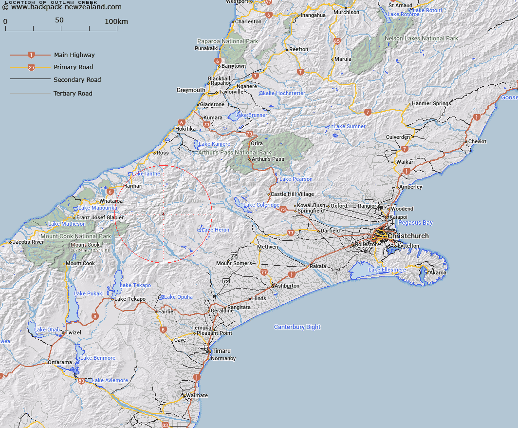
Map showing location of Outlaw Creek


LINZ description: A tributary of the Lawrence River
Latitude: -43.357628
Longitude: 170.886102
Northing: 5197300
Easting: 1428700
Land District: Canterbury
Feat Type: Stream


Scroll down to see a more detailed road map and below that a topographical map showing the location of Outlaw Creek. The road map has been supplied by openstreetmap and the topographical map of Outlaw Creek has been supplied by Land Information New Zealand (LINZ).

Yes you can use the top static map for you school/university project or personal website with a link back. Contact me for any commercial use.

Outlaw Creek Map New Zealand


New Zealand places in our database
[ A ] [ B ] [ C ] [ D ] [ E ] [ F ] [ G ] [ H ] [ I ] [ J ] [ K ] [ L ] [ M ] [ N ] [ O ] [ P ] [ Q ] [ R ] [ S ] [ T ] [ U ] [ V ] [ W ] [ X ] [ Y ] [ Z ]


Closest 20 Streams to Outlaw Creek

Moses Creek ( 3.19km )   Kirk Stream ( 5.11km )   Billy McCoy Creek ( 5.78km )   Sinclair River ( 6.32km )   Reischek Stream ( 8.06km )   McCoy Stream ( 8.47km )   Shingly Stream ( 8.63km )   Lawrence River ( 9.6km )   Frances River ( 10.32km )   Argument Creek ( 10.74km )   Mad Water ( 10.76km )   Tauroa Creek ( 11.05km )   Spean Stream ( 11.41km )   Louper Stream ( 11.44km )   Lauper Stream ( 11.44km )   Cattle Creek ( 11.45km )   Swift Water ( 11.48km )   Potts River ( 11.49km )   Wildsheep Stream ( 11.53km )   Agnes Stream ( 11.78km )   Fury Torrent ( 11.81km )   Emily Creek ( 12.17km )   Bull Spur Stream ( 12.33km )   Lochaber Stream ( 12.64km )   Clyde River ( 12.73km )   Stumpy Stream ( 12.91km )   Jagged Stream ( 13.13km )   Lord River ( 13.86km )   Lochiel Stream ( 14.62km )   Veil Stream ( 14.89km )   Cameron River ( 15.4km )   Fan Stream ( 15.55km )   Vane Stream ( 15.65km )   Duncan Creek ( 15.87km )   Coronation Stream ( 15.93km )   Strone Stream ( 16.02km )   Washbourne Creek ( 16.07km )   Evans River ( 16.38km )   Caper Torrent ( 16.87km )   Cloudy Stream ( 16.88km )