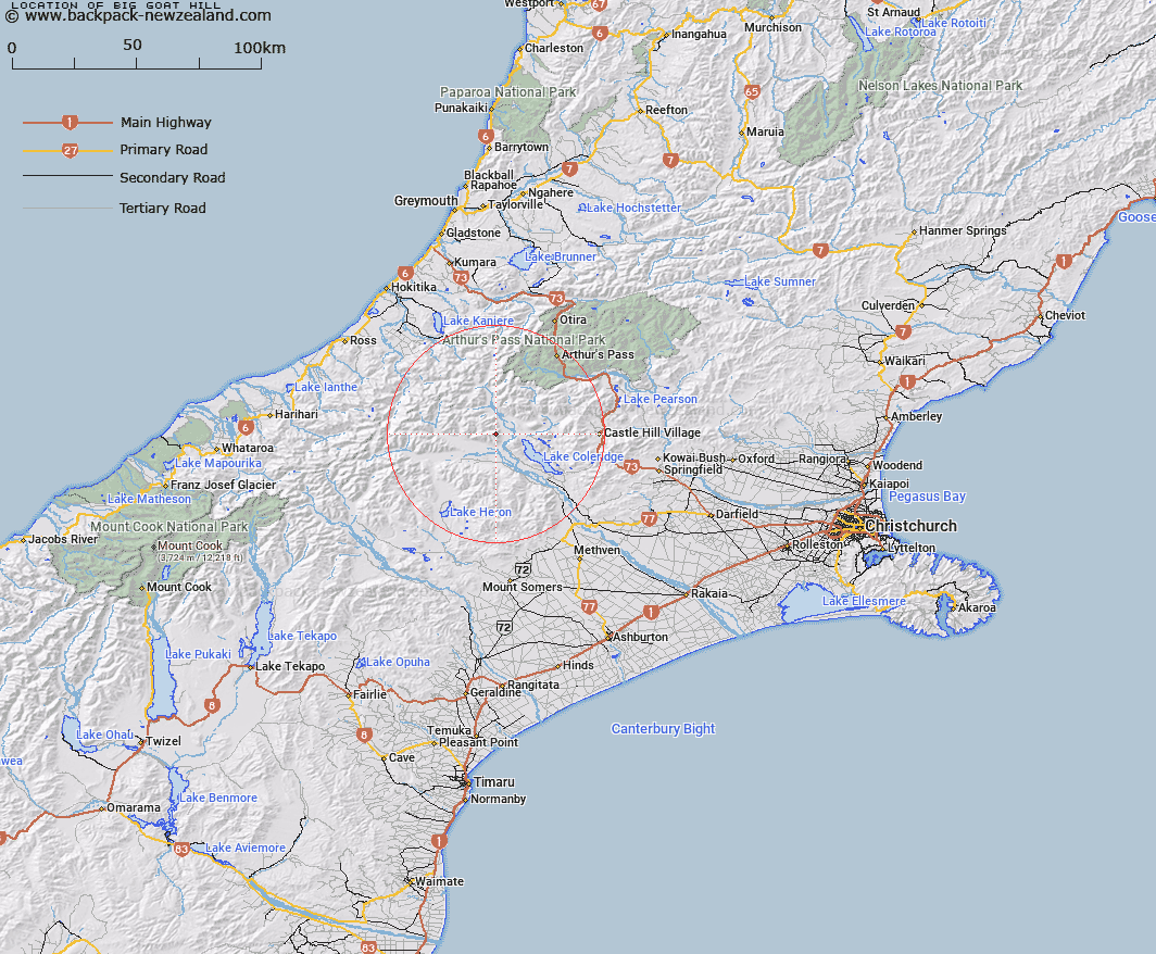
Map showing location of Big Goat Hill


LINZ description: Hill at the South-eastern end of the Rolleston Range, 3km South-east of Mount Gideon. Block XIV, Wilberforce Survey District.
Latitude: -43.213014
Longitude: 171.351488
Northing: 5214210.7
Easting: 1466096.4
Land District: Canterbury
Feat Type: Hill


Scroll down to see a more detailed road map and below that a topographical map showing the location of Big Goat Hill. The road map has been supplied by openstreetmap and the topographical map of Big Goat Hill has been supplied by Land Information New Zealand (LINZ).

Yes you can use the top static map for you school/university project or personal website with a link back. Contact me for any commercial use.

Big Goat Hill Map New Zealand


New Zealand places in our database
[ A ] [ B ] [ C ] [ D ] [ E ] [ F ] [ G ] [ H ] [ I ] [ J ] [ K ] [ L ] [ M ] [ N ] [ O ] [ P ] [ Q ] [ R ] [ S ] [ T ] [ U ] [ V ] [ W ] [ X ] [ Y ] [ Z ]


Closest 20 Hills to Big Goat Hill

Mount Algidus ( 2.77km )   Mount Gideon ( 3.01km )   Little Goat Hill ( 4.41km )   Kruger Hill ( 4.73km )   Scarcliffe ( 5.4km )   Turret Peak ( 5.44km )   Mount Oakden ( 6.34km )   Cliff Hill ( 6.5km )   Castle Hill ( 6.91km )   Jacks Hill ( 7.87km )   Double Hill ( 9.93km )   Woolshed Hill ( 10.52km )   Gargarus ( 11.66km )   Mistake Hill ( 12.84km )   Fang Hill ( 13.05km )   Mount Cotton ( 13.08km )   Moa Hill ( 13.19km )   Homestead Hill ( 14.48km )   Mount Ida ( 14.66km )   Fitzwilliam Mountain ( 14.9km )   Manuka Peak ( 15.06km )   Little Mount Ida ( 15.35km )   Mount O'Connor ( 15.62km )   Carriage Drive ( 15.94km )   Peak Hill ( 16.24km )   Mount Findlay ( 16.5km )   Donald Hill ( 16.84km )   Mount Hennah ( 17.09km )   Godley Peak ( 17.12km )   Little Knuckles ( 17.65km )   Thesis Peak ( 17.86km )   Moorhouse Peak ( 18.04km )   Round Hill ( 18.12km )   Smite Peak ( 18.12km )   Whaleback ( 18.17km )   Sebastopol ( 18.87km )   Knuckles ( 19.04km )   Mount Treadwell ( 19.73km )   Goldney Hill ( 19.84km )   Mount Bryce ( 19.91km )