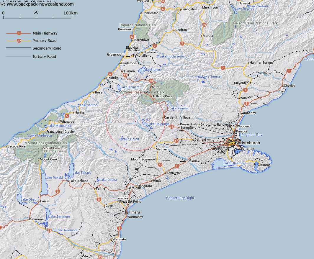
Map showing location of Kruger Hill


LINZ description: The hill behind Mount Algidus Station and the Wilberforce River, being the lower southern slopes of Mount Algidus. Block II Oakden Survey District.
Latitude: -43.254545
Longitude: 171.364375
Northing: 5209619
Easting: 1467233.4
Land District: Canterbury
Feat Type: Hill


Scroll down to see a more detailed road map and below that a topographical map showing the location of Kruger Hill. The road map has been supplied by openstreetmap and the topographical map of Kruger Hill has been supplied by Land Information New Zealand (LINZ).

Yes you can use the top static map for you school/university project or personal website with a link back. Contact me for any commercial use.

Kruger Hill Map New Zealand


New Zealand places in our database
[ A ] [ B ] [ C ] [ D ] [ E ] [ F ] [ G ] [ H ] [ I ] [ J ] [ K ] [ L ] [ M ] [ N ] [ O ] [ P ] [ Q ] [ R ] [ S ] [ T ] [ U ] [ V ] [ W ] [ X ] [ Y ] [ Z ]


Closest 20 Hills to Kruger Hill

Cliff Hill ( 1.89km )   Mount Algidus ( 2.06km )   Mount Oakden ( 4.37km )   Big Goat Hill ( 4.73km )   Little Goat Hill ( 5.16km )   Woolshed Hill ( 6.03km )   Double Hill ( 6.32km )   Mount Gideon ( 7.62km )   Castle Hill ( 8.89km )   Turret Peak ( 9.71km )   Scarcliffe ( 10.13km )   Jacks Hill ( 10.85km )   Homestead Hill ( 11.22km )   Mount Cotton ( 11.34km )   Donald Hill ( 12.11km )   Peak Hill ( 12.46km )   Gargarus ( 12.67km )   Mount O'Connor ( 12.83km )   Godley Peak ( 13.22km )   Carriage Drive ( 13.58km )   Little Mount Ida ( 14.05km )   Moorhouse Peak ( 14.14km )   Mount Ida ( 14.25km )   Smite Peak ( 15.02km )   Mount Hennah ( 15.15km )   Manuka Peak ( 15.24km )   Mistake Hill ( 15.3km )   Black Hill ( 15.31km )   Round Hill ( 15.78km )   Fitzwilliam Mountain ( 16.26km )   Little Knuckles ( 16.37km )   Lagoon Peak ( 16.82km )   Whaleback ( 16.98km )   Redcliffe Hill ( 17.49km )   Fang Hill ( 17.55km )   Knuckles ( 17.89km )   Moa Hill ( 17.89km )   Laings Hill ( 18km )   Goldney Hill ( 18.01km )   Round Hill ( 18.09km )