Map showing location of Ben-nagar


LINZ description: Peak in Richardson Mountains west of Lochnagar (Lake). Forbes Survey District.
Latitude: -44.595076
Longitude: 168.568374
Northing: 5052469.9
Easting: 1248263.5
Land District: Otago
Feat Type: Hill


Scroll down to see a more detailed road map and below that a topographical map showing the location of Ben-nagar. The road map has been supplied by openstreetmap and the topographical map of Ben-nagar has been supplied by Land Information New Zealand (LINZ).

Yes you can use the top static map for you school/university project or personal website with a link back. Contact me for any commercial use.
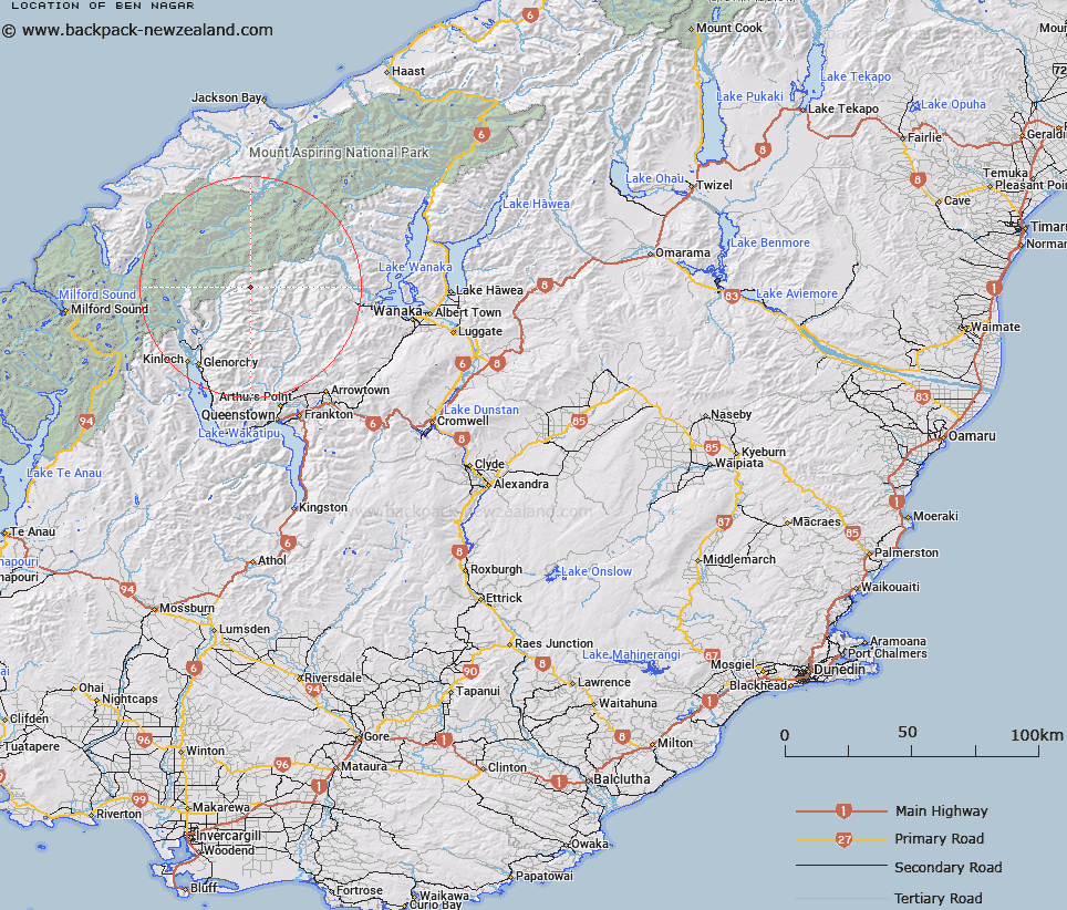
Ben-nagar Map New Zealand


New Zealand places in our database
[ A ] [ B ] [ C ] [ D ] [ E ] [ F ] [ G ] [ H ] [ I ] [ J ] [ K ] [ L ] [ M ] [ N ] [ O ] [ P ] [ Q ] [ R ] [ S ] [ T ] [ U ] [ V ] [ W ] [ X ] [ Y ] [ Z ]


Closest 20 Hills to Ben-nagar

Little Ben-nagar Peak ( 1.42km )   Little Lochnagar ( 1.42km )   Cleft Peak ( 3.5km )   Mount Lima ( 5.63km )   Lapith Peak ( 5.8km )   Headlong Peak ( 6.42km )   Mount Tewha ( 6.53km )   Mount Cunningham ( 6.61km )   Mount Ferguson ( 7.36km )   Mount Clarke ( 8.49km )   Mount Tyndall ( 9.21km )   Osonzac Twins ( 10.18km )   Ellie Peak ( 10.43km )   Savage Peak ( 10.5km )   Mount Ansted ( 10.51km )   Mount Greenland ( 10.74km )   Moira Peak ( 10.77km )   Mount Repulse ( 11.22km )   Red Rock ( 11.28km )   Bowyang Mount ( 11.62km )   Mount Head ( 11.79km )   Black Peak ( 12.37km )   Humboldt Tower ( 12.45km )   O'Leary Peak ( 12.68km )   Leary Peak ( 12.68km )   East Peak ( 12.85km )   Sir William Peak ( 12.98km )   Key Dome ( 13.2km )   Head Peak ( 13.24km )   Mount Campbell ( 13.25km )   Mount Troas ( 13.44km )   Marion Tower ( 13.49km )   Cone Hill ( 13.58km )   Mount Earnslaw/Pikirakatahi ( 13.92km )   Mount Earnslaw ( 13.92km )   Ferrier Peak ( 13.99km )   West Peak ( 14.11km )   Bernard Peak ( 14.13km )   Mount Ian ( 14.21km )   Mount Cerberus ( 14.29km )