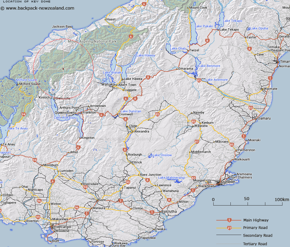
Map showing location of Key Dome


LINZ description: A long snow dome leading to the base of Mount Amundsen, between the Blue Duck and Whitbourn Rivers under the Snowdrift Range.
Latitude: -44.484418
Longitude: 168.508074
Northing: 5064500
Easting: 1242800
Land District: Otago
Feat Type: Hill


Scroll down to see a more detailed road map and below that a topographical map showing the location of Key Dome. The road map has been supplied by openstreetmap and the topographical map of Key Dome has been supplied by Land Information New Zealand (LINZ).

Yes you can use the top static map for you school/university project or personal website with a link back. Contact me for any commercial use.

Key Dome Map New Zealand


New Zealand places in our database
[ A ] [ B ] [ C ] [ D ] [ E ] [ F ] [ G ] [ H ] [ I ] [ J ] [ K ] [ L ] [ M ] [ N ] [ O ] [ P ] [ Q ] [ R ] [ S ] [ T ] [ U ] [ V ] [ W ] [ X ] [ Y ] [ Z ]


Closest 20 Hills to Key Dome

Mount Amundsen ( 1.19km )   Mount Tiber ( 1.78km )   Mount Lydia ( 2.08km )   Mount Ian ( 2.49km )   Bernard Peak ( 2.82km )   Ferrier Peak ( 3.29km )   Alpha Mountain ( 3.63km )   Mount Troas ( 3.69km )   The Snowman Peak ( 3.71km )   Mount Beta ( 3.88km )   Humboldt Tower ( 3.91km )   Gamma Mountain ( 4.11km )   Mount Victoria ( 4.15km )   Delta Mountain ( 4.45km )   Marion Tower ( 4.63km )   Pivot Peak ( 6.14km )   Frobisher Mountain ( 6.35km )   Mount Edward ( 6.39km )   Mount Cunningham ( 6.69km )   Mount Peary ( 6.9km )   Mount Maoriori ( 6.92km )   Mount Maoriri ( 6.92km )   Chancellor ( 7.67km )   Mount Clarke ( 7.79km )   Mount Maruiwi ( 8.24km )   Nansen Peak ( 8.37km )   Osonzac Twins ( 8.59km )   Headlong Peak ( 9.04km )   Mount Ansted ( 9.05km )   Ellie Peak ( 9.09km )   Five Fingers ( 9.24km )   Maiti-iti ( 9.4km )   Mount Tewha ( 9.41km )   Moira Peak ( 9.54km )   Camp Oven Dome ( 9.55km )   Pyramid ( 9.63km )   Cleft Peak ( 9.7km )   Mount Maori ( 9.74km )   Buttress ( 9.8km )   Plunket Dome ( 10.02km )