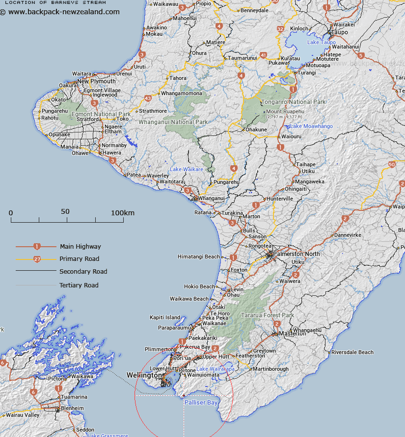
Map showing location of Barneys Stream


LINZ description: source located in the lower south Rimutaka range with the outlet into Palliser Bay, north of Turakirae Head.
Latitude: -41.412872
Longitude: 174.93595
Northing: 5413600
Easting: 1761800
Land District: Wellington
Feat Type: Stream


Scroll down to see a more detailed road map and below that a topographical map showing the location of Barneys Stream. The road map has been supplied by openstreetmap and the topographical map of Barneys Stream has been supplied by Land Information New Zealand (LINZ).

Yes you can use the top static map for you school/university project or personal website with a link back. Contact me for any commercial use.

Barneys Stream Map New Zealand


New Zealand places in our database
[ A ] [ B ] [ C ] [ D ] [ E ] [ F ] [ G ] [ H ] [ I ] [ J ] [ K ] [ L ] [ M ] [ N ] [ O ] [ P ] [ Q ] [ R ] [ S ] [ T ] [ U ] [ V ] [ W ] [ X ] [ Y ] [ Z ]


Closest 20 Streams to Barneys Stream

Waimarara Stream ( 1.25km )   Kotumu Stream ( 1.56km )   Red Rock Stream ( 2.12km )   Orongorongo River ( 2.36km )   Peak Stream ( 3.29km )   Plumbago Stream ( 4.2km )   Mukamukaiti Stream ( 4.26km )   Karaka Stream ( 4.34km )   Wootton Stream ( 5.13km )   Matai Stream ( 5.17km )   Okakaho Stream ( 5.77km )   Wainuiomata River ( 5.8km )   Nettle Stream ( 5.82km )   Paiaka Stream ( 6.39km )   Tapokopoko Stream ( 6.4km )   Greens Stream ( 6.89km )   Hinakitaka Stream ( 7.54km )   Browns Stream ( 8.02km )   Mukamuka Stream ( 8.1km )   Thistle Stream ( 8.21km )   Catchpool Stream ( 8.33km )   Catchpole Stream ( 8.33km )   Gollans Stream ( 8.36km )   Graces Stream ( 9.11km )   Goat Stream ( 9.15km )   Big Bend ( 9.24km )   Cameron Creek ( 9.46km )   Champagne Creek ( 10.05km )   McKerrow Stream ( 10.05km )   Corner Creek ( 10.18km )   Matthews Stream ( 10.28km )   Turere Stream ( 10.3km )   Whakanui Creek ( 11.5km )   Wharekauhau Stream ( 11.96km )   Butterfly Creek ( 12.74km )   Papatahi Stream ( 12.81km )   Boulder Creek ( 12.95km )   Scholes Creek ( 13.19km )   Scholl Creek ( 13.19km )   North Boulder Creek ( 13.34km )