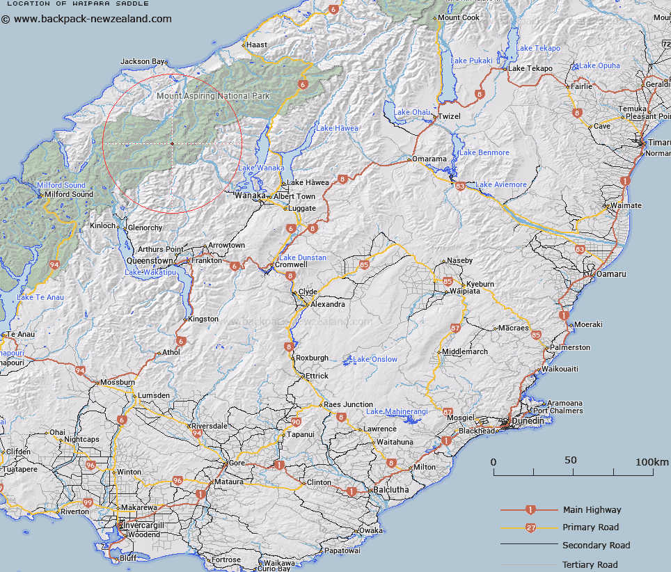
Map showing location of Waipara Saddle


LINZ description: Between the headwaters of the Waipara and Arawata Rivers, and being the lowest part of the ridge between Mounts Athene and Barff. Cascade Survey District.
Latitude: -44.400246
Longitude: 168.649487
Northing: 5074459.3
Easting: 1253547.6
Land District: Otago
Feat Type: Pass


Scroll down to see a more detailed road map and below that a topographical map showing the location of Waipara Saddle. The road map has been supplied by openstreetmap and the topographical map of Waipara Saddle has been supplied by Land Information New Zealand (LINZ).

Yes you can use the top static map for you school/university project or personal website with a link back. Contact me for any commercial use.

Waipara Saddle Map New Zealand


New Zealand places in our database
[ A ] [ B ] [ C ] [ D ] [ E ] [ F ] [ G ] [ H ] [ I ] [ J ] [ K ] [ L ] [ M ] [ N ] [ O ] [ P ] [ Q ] [ R ] [ S ] [ T ] [ U ] [ V ] [ W ] [ X ] [ Y ] [ Z ]


Closest 20 Passs to Waipara Saddle

Matukituki Saddle ( 1.49km )   Hector Col ( 1.85km )   Arawata Saddle ( 2.83km )   Arawhata Saddle ( 2.83km )   Bevan Col ( 3.48km )   Pakeha Col ( 4.95km )   Quarterdeck Pass ( 5.85km )   Mystery Col ( 7.41km )   Whitbourn Saddle ( 8.21km )   Cascade Saddle ( 8.65km )   Parachute Col ( 9.1km )   South Snowball Saddle ( 9.6km )   Snowball Saddle ( 9.6km )   Moncrieff Col ( 10.19km )   Rainbow Col ( 11.3km )   Snowdrift Saddle ( 12.35km )   North Snowball Saddle ( 12.35km )   Shotover Saddle ( 13.77km )   Boys Col ( 14.33km )   Wilmot Saddle ( 14.64km )   Arcade Saddle ( 17.8km )   Halfway Saddle ( 18.05km )   Albert Burn Saddle ( 18.17km )   Rees Saddle ( 18.27km )   Pearson Saddle ( 18.54km )   Rabbit Pass ( 18.65km )   Tornado Saddle ( 18.67km )   Persephone Col ( 19.12km )   O'Leary Pass ( 19.45km )   Trinity Col ( 19.63km )   Invitation Col ( 20.51km )   Trinity Pass ( 21.06km )   Hurricane Col ( 21.35km )   Twenty Five Mile Saddle ( 21.67km )   Pyramid Col ( 22.4km )   False Col ( 22.51km )   Chasm Pass ( 22.98km )   Solution Col ( 23km )   Pic d'argent Col ( 23.38km )   Simonin Pass ( 23.88km )