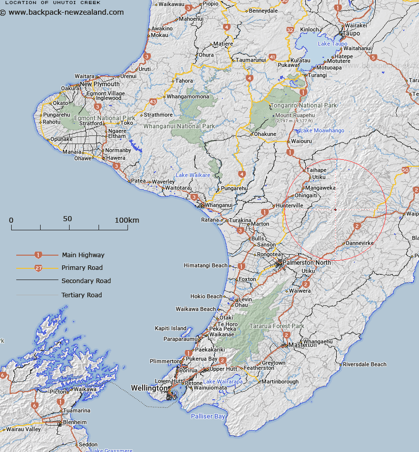
Map showing location of Umutoi Creek


LINZ description: It rises at the northern end of Ngamoko Range in Ruahine Forest Park and flows easterly into Oroua River.
Latitude: -39.962663
Longitude: 176.03449
Northing: 5571976.2
Easting: 1859185.6
Land District: Wellington
Feat Type: Stream


Scroll down to see a more detailed road map and below that a topographical map showing the location of Umutoi Creek. The road map has been supplied by openstreetmap and the topographical map of Umutoi Creek has been supplied by Land Information New Zealand (LINZ).

Yes you can use the top static map for you school/university project or personal website with a link back. Contact me for any commercial use.

Umutoi Creek Map New Zealand


New Zealand places in our database
[ A ] [ B ] [ C ] [ D ] [ E ] [ F ] [ G ] [ H ] [ I ] [ J ] [ K ] [ L ] [ M ] [ N ] [ O ] [ P ] [ Q ] [ R ] [ S ] [ T ] [ U ] [ V ] [ W ] [ X ] [ Y ] [ Z ]


Closest 20 Streams to Umutoi Creek

Umutoi Creek ( 0km )   Tunupo Creek ( 1.4km )   Cumberfield Creek ( 1.4km )   Cone Creek ( 1.95km )   Tunupo Creek ( 3.42km )   Tunup? Creek ( 3.42km )   Limestone Creek ( 5.12km )   Iron Gate Creek ( 5.67km )   Howlett Creek ( 6.17km )   Makiekie (Coal) Creek ( 6.34km )   Horopito Stream ( 7.06km )   Scandlyn Creek ( 8.01km )   Piripiri Stream ( 8.43km )   North Branch Makaretu River ( 8.67km )   Kaheke Stream ( 8.68km )   Oxford Creek ( 8.93km )   Te Ano Whiro Stream ( 9.15km )   Hutewai Stream ( 9.33km )   Piripiri Stream ( 9.42km )   Stoney Creek ( 9.44km )   Mangahuia Stream ( 11.15km )   Pari Stream ( 11.3km )   South Branch Mangatewai Stream ( 11.45km )   Kainga Stream ( 11.48km )   Moorcock Stream ( 11.73km )   Mangoira Stream ( 11.77km )   Whaingapuna Stream ( 11.89km )   North Branch Tukituki River ( 11.96km )   Burtons Stream ( 12.46km )   Pataka Stream ( 12.51km )   Makoura Stream ( 12.83km )   Tukituki River ( 12.94km )   North Branch Mangatewai Stream ( 13.28km )   Todea Stream ( 13.31km )   Delaware Stream ( 13.45km )   Mahuraunui Stream (Stoney Creek) ( 13.73km )   Porongaki Stream ( 13.84km )   Konewa Stream ( 14.09km )   Mangatewainui River ( 14.44km )   Pine Stream ( 15.06km )