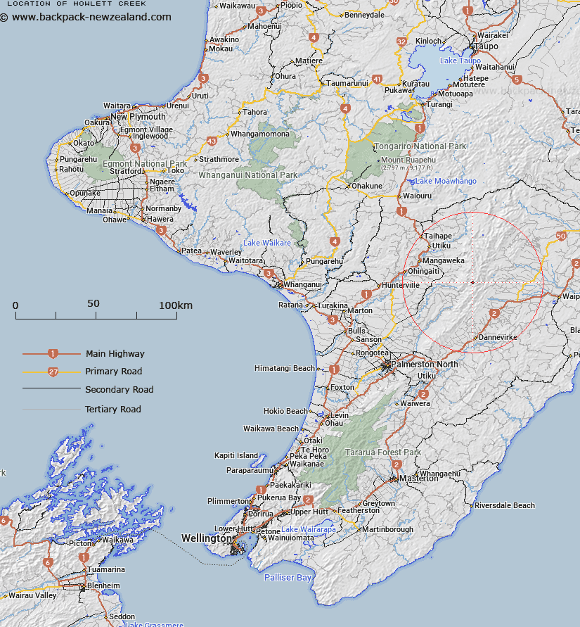
Map showing location of Howlett Creek


LINZ description: Flowing south-westerly from Tiraha (hill) into Oroua River, Ruahine Range. NZTopo50 BL36-Norsewood, source: GR 669 799 to confluence: GR 626 767.
Latitude: -39.920287
Longitude: 176.081145
Northing: 5576544
Easting: 1863333.8
Land District: Wellington
Feat Type: Stream


Scroll down to see a more detailed road map and below that a topographical map showing the location of Howlett Creek. The road map has been supplied by openstreetmap and the topographical map of Howlett Creek has been supplied by Land Information New Zealand (LINZ).

Yes you can use the top static map for you school/university project or personal website with a link back. Contact me for any commercial use.

Howlett Creek Map New Zealand


New Zealand places in our database
[ A ] [ B ] [ C ] [ D ] [ E ] [ F ] [ G ] [ H ] [ I ] [ J ] [ K ] [ L ] [ M ] [ N ] [ O ] [ P ] [ Q ] [ R ] [ S ] [ T ] [ U ] [ V ] [ W ] [ X ] [ Y ] [ Z ]


Closest 20 Streams to Howlett Creek

Iron Gate Creek ( 1.32km )   Oxford Creek ( 2.77km )   Tunupo Creek ( 3.13km )   Tunup? Creek ( 3.13km )   Cumberfield Creek ( 4.97km )   Tunupo Creek ( 4.97km )   North Branch Tukituki River ( 5.86km )   Umutoi Creek ( 6.17km )   Tukituki River ( 7.3km )   Moorcock Stream ( 7.64km )   North Branch Makaretu River ( 8.09km )   Cone Creek ( 8.1km )   Pari Stream ( 8.4km )   Tussock Creek ( 9.11km )   South Branch Mangatewai Stream ( 9.27km )   Pinnacle Creek ( 10.04km )   Waterfall Creek ( 10.3km )   North Branch Mangatewai Stream ( 10.42km )   Scandlyn Creek ( 10.54km )   Limestone Creek ( 10.78km )   Rangi Creek ( 11.04km )   Iron Peg Creek ( 11.08km )   Mangakokeke Stream ( 11.18km )   Trig Creek ( 11.41km )   Stoney Creek ( 11.44km )   Makiekie (Coal) Creek ( 11.65km )   Pourangaki River ( 12.65km )   Horopito Stream ( 12.94km )   Smith Creek ( 13.29km )   Mangahuia Stream ( 13.58km )   Kaheke Stream ( 13.97km )   Mahuraunui Stream (Stoney Creek) ( 14.05km )   Hylton Burn ( 14.34km )   Porongaki Stream ( 14.36km )   Piripiri Stream ( 14.44km )   Mangatewai River ( 14.73km )   Mangakukeke Stream ( 15km )   Mangoira Stream ( 15.05km )   Hikurangi Stream ( 15.26km )   Te Ano Whiro Stream ( 15.27km )