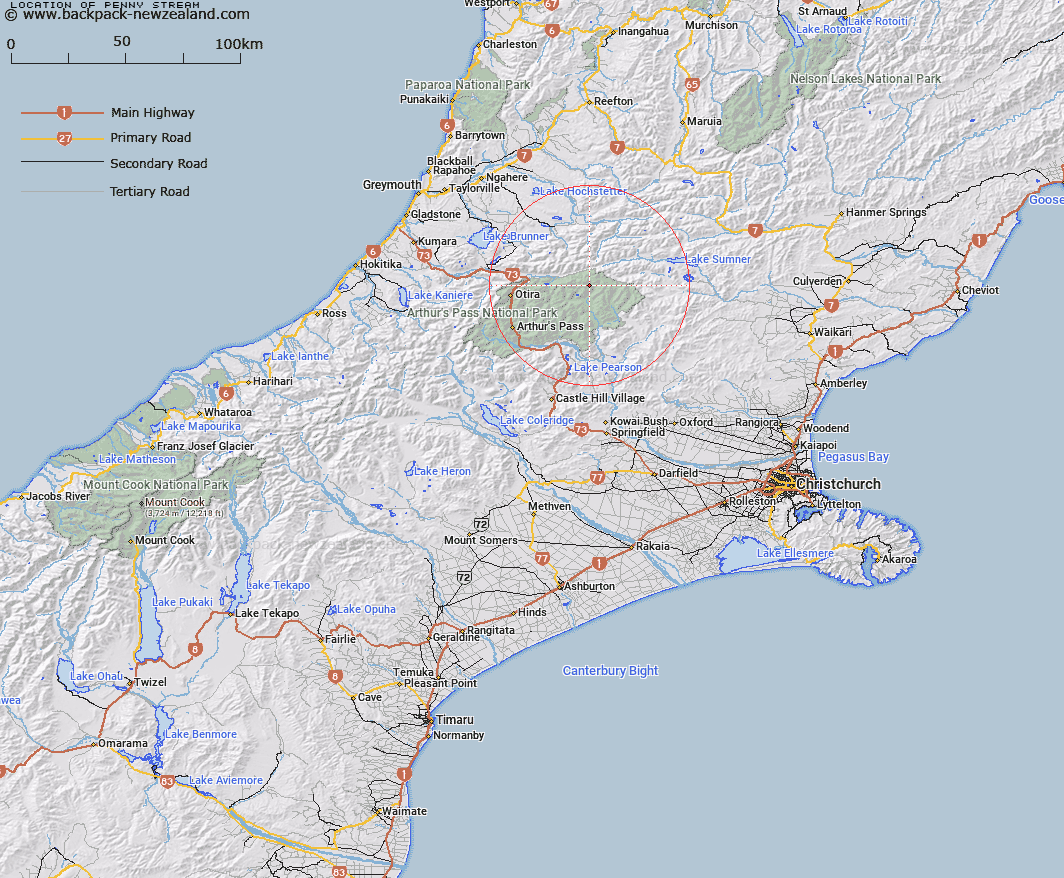
Map showing location of Penny Stream


LINZ description: Right bank tributary of Thompson Stream, flowing eastward from Penny Pass and joining Thompson Stream 2.2km upstream of Cherrywood Creek. Blocks V and VI, Minchin Survey District.
Latitude: -42.79099
Longitude: 171.860288
Northing: 5261765.1
Easting: 1506789.2
Land District: Canterbury
Feat Type: Stream


Scroll down to see a more detailed road map and below that a topographical map showing the location of Penny Stream. The road map has been supplied by openstreetmap and the topographical map of Penny Stream has been supplied by Land Information New Zealand (LINZ).

Yes you can use the top static map for you school/university project or personal website with a link back. Contact me for any commercial use.

Penny Stream Map New Zealand


New Zealand places in our database
[ A ] [ B ] [ C ] [ D ] [ E ] [ F ] [ G ] [ H ] [ I ] [ J ] [ K ] [ L ] [ M ] [ N ] [ O ] [ P ] [ Q ] [ R ] [ S ] [ T ] [ U ] [ V ] [ W ] [ X ] [ Y ] [ Z ]


Closest 20 Streams to Penny Stream

Thompson Stream ( 1.69km )   Cherrywood Creek ( 2.8km )   Morrison Stream ( 3.07km )   Locke Creek ( 4.37km )   Townsend Creek ( 4.39km )   Wilkinson Creek ( 4.39km )   Linwood Creek ( 4.93km )   Ranger Stream ( 6.11km )   Minchin Stream ( 6.49km )   Poulter River ( 7.71km )   Hurunui River South Branch ( 7.74km )   Blockhouse Stream ( 7.95km )   Dixon Creek ( 8.04km )   Joseph Creek ( 8.21km )   Fenwick Stream ( 8.4km )   Montgomery Stream ( 8.44km )   Yeo Creek ( 8.75km )   Row Stream ( 8.76km )   Cox River ( 9.33km )   Ellis Stream ( 9.48km )   Trent River ( 9.87km )   Michael Creek ( 10.42km )   Trudge Stream ( 10.73km )   Enchanted Stream ( 10.75km )   Jacksons Creek ( 10.87km )   Chasm Stream ( 10.96km )   Tawhana Stream ( 11.28km )   Koropuku Creek ( 11.34km )   Cochran Stream ( 11.63km )   Whio Stream ( 12km )   Blue Stream ( 12.04km )   Casey Stream ( 12.17km )   Cameron Stream ( 12.27km )   Otehake River ( 12.62km )   Hurunui River ( 12.78km )   Taverners Creek ( 12.79km )   Beckett Stream ( 13.19km )   Graf Creek ( 13.25km )   Bull Creek ( 13.41km )   Camp Stream ( 13.43km )