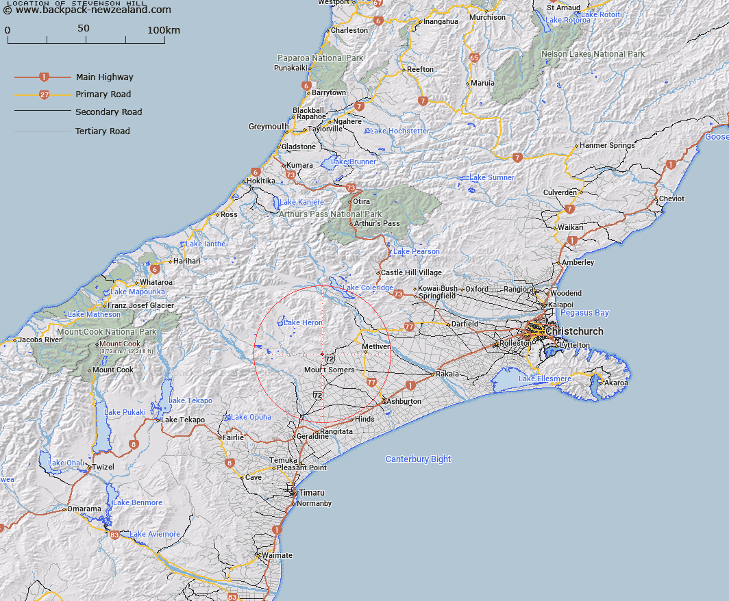
Map showing location of Stevenson Hill


LINZ description: A hill south-east of Staveley Hill in between Stevenson and Reid Streams
Latitude: -43.645334
Longitude: 171.406814
Northing: 5166284.8
Easting: 1471508.5
Land District: Canterbury
Feat Type: Hill


Scroll down to see a more detailed road map and below that a topographical map showing the location of Stevenson Hill. The road map has been supplied by openstreetmap and the topographical map of Stevenson Hill has been supplied by Land Information New Zealand (LINZ).

Yes you can use the top static map for you school/university project or personal website with a link back. Contact me for any commercial use.

Stevenson Hill Map New Zealand


New Zealand places in our database
[ A ] [ B ] [ C ] [ D ] [ E ] [ F ] [ G ] [ H ] [ I ] [ J ] [ K ] [ L ] [ M ] [ N ] [ O ] [ P ] [ Q ] [ R ] [ S ] [ T ] [ U ] [ V ] [ W ] [ X ] [ Y ] [ Z ]


Closest 20 Hills to Stevenson Hill

Hookey Knob ( 1.7km )   Fagan Hill ( 1.99km )   Cox Hills ( 2.04km )   Staveley Hill ( 2.45km )   Duke Knob ( 2.56km )   Ouke Knob ( 2.56km )   Mount Somers ( 3.84km )   Pony Knob ( 4.74km )   Mount Winterslow ( 7.21km )   The Brothers ( 8.67km )   Mount Alford ( 8.8km )   Woolmer Hill ( 10.96km )   Pudding Hill ( 11.43km )   Mount Barrosa ( 14.49km )   Old Man Peak ( 14.64km )   Rock Pillar ( 15.5km )   Sandys Knob ( 15.55km )   The Fingers ( 15.88km )   Mount Taylor ( 16.9km )   Mount Bruce ( 17.24km )   Emily Hill ( 17.82km )   Mount Pukanui ( 18.44km )   Trinity Hill ( 18.71km )   Mount Tripp ( 18.83km )   Mount Hecla ( 19.06km )   South Peak ( 19.93km )   Mount Possession ( 20.66km )   Isolated Hill ( 21.48km )   Mount Hutt ( 21.58km )   Turton Tops ( 22.84km )   Low Hills ( 23.36km )   Rat Hill ( 24.4km )   Shingle Hill ( 24.81km )   Lake Hill ( 25.18km )   Dogs Hill ( 25.28km )   Bryans Hill ( 25.52km )   Cairn Hill ( 26.09km )   Coal Hill ( 26.12km )   Round Hill ( 26.43km )   Steepface Hill ( 26.5km )