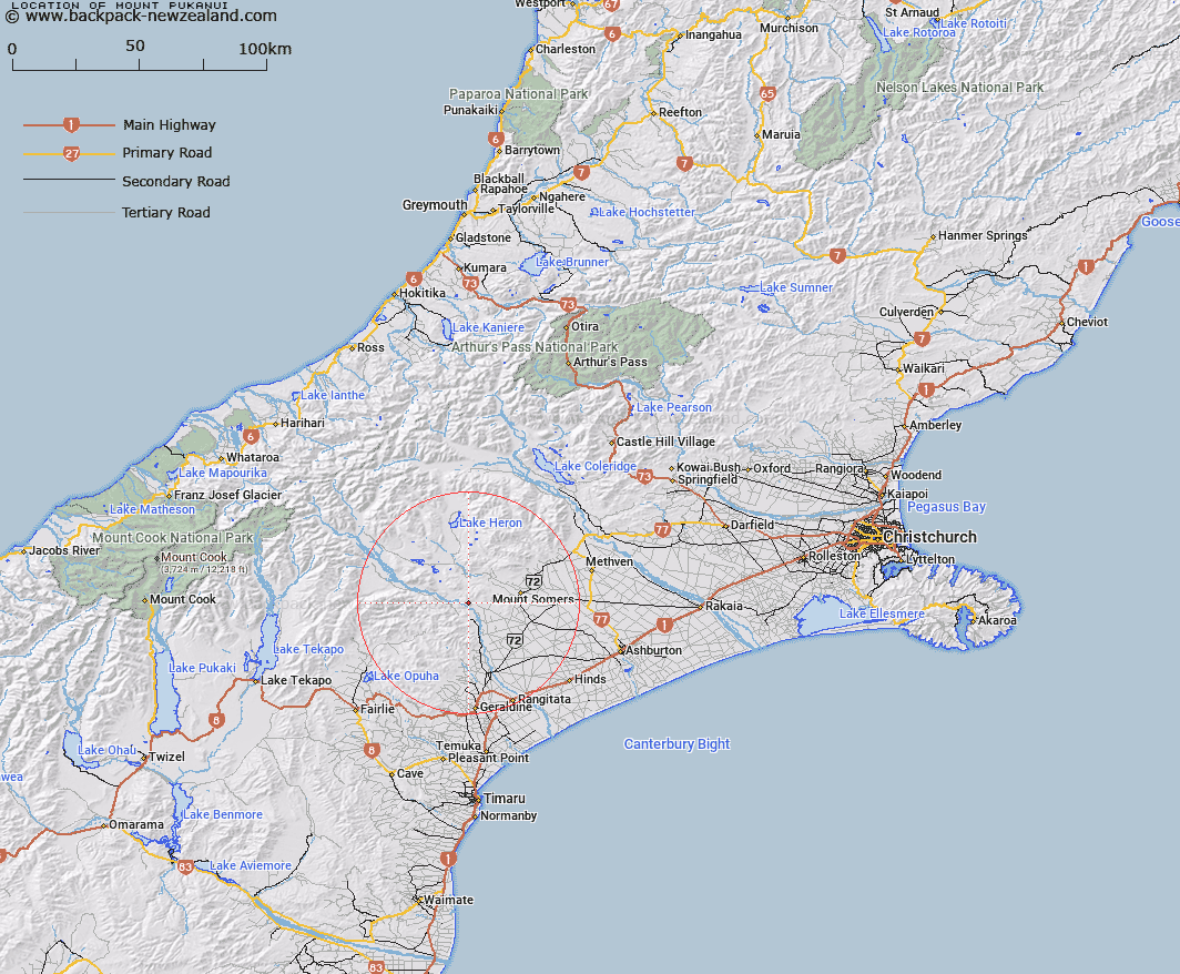
Map showing location of Mount Pukanui


LINZ description: A peak between the Rangitata River and Hinds River at the south end of Moorehouse Range.
Latitude: -43.742909
Longitude: 171.221363
Northing: 5155143.9
Easting: 1456784
Land District: Canterbury
Feat Type: Hill


Scroll down to see a more detailed road map and below that a topographical map showing the location of Mount Pukanui. The road map has been supplied by openstreetmap and the topographical map of Mount Pukanui has been supplied by Land Information New Zealand (LINZ).

Yes you can use the top static map for you school/university project or personal website with a link back. Contact me for any commercial use.

Mount Pukanui Map New Zealand


New Zealand places in our database
[ A ] [ B ] [ C ] [ D ] [ E ] [ F ] [ G ] [ H ] [ I ] [ J ] [ K ] [ L ] [ M ] [ N ] [ O ] [ P ] [ Q ] [ R ] [ S ] [ T ] [ U ] [ V ] [ W ] [ X ] [ Y ] [ Z ]


Closest 20 Hills to Mount Pukanui

Mount Tripp ( 6.62km )   Coal Hill ( 7.7km )   Low Hills ( 8.06km )   Woolmer Hill ( 10.11km )   Sandys Knob ( 10.51km )   Mount Possession ( 10.95km )   The Brothers ( 11.74km )   Mount Peel ( 12.63km )   Cairn Hill ( 13.37km )   Trinity Hill ( 13.46km )   Middle Mount Peel ( 13.54km )   Mount Barrosa ( 13.61km )   Little Mount Peel ( 15.36km )   Little Mount Peel/Huatekerekere ( 15.36km )   Cox Hills ( 16.41km )   Fagan Hill ( 16.46km )   Mount Harper ( 16.58km )   Mount Harper/Mahaanui ( 16.58km )   Staveley Hill ( 17.84km )   Rawtor ( 18.28km )   Stevenson Hill ( 18.44km )   Mount Somers ( 18.48km )   Grants Top ( 18.99km )   Mount Frances ( 19.58km )   Hookey Knob ( 19.59km )   Mount Guy ( 20.08km )   Mount Edith ( 20.4km )   Ouke Knob ( 20.46km )   Duke Knob ( 20.46km )   Pony Knob ( 20.96km )   Dogs Hill ( 20.99km )   Ben McLeod ( 21.56km )   Mount Winterslow ( 22.68km )   Emily Hill ( 22.83km )   Mount Catherine ( 23.16km )   Isolated Hill ( 23.81km )   Blue Mountain ( 24.49km )   The Fingers ( 24.93km )   Ben Hope ( 25.94km )   Tripps Peak ( 26.18km )