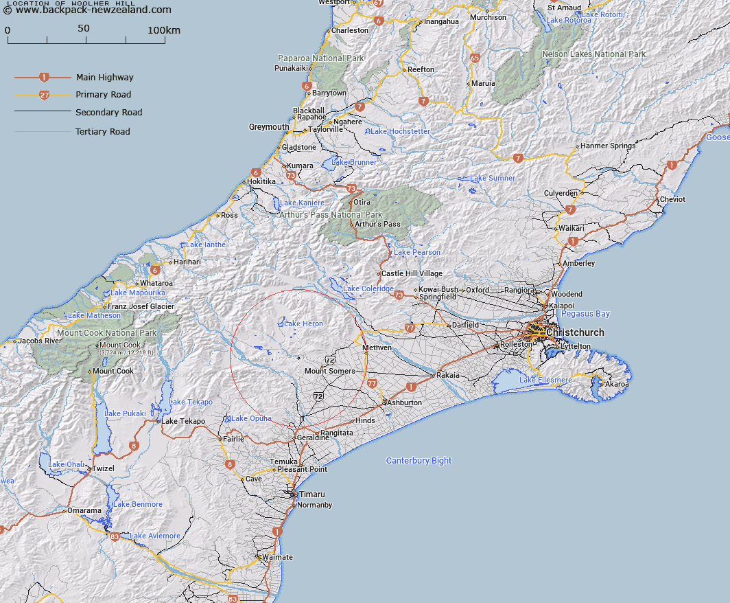
Map showing location of Woolmer Hill


LINZ description: Hill feature in between South Branch Ashburton River and Blondin Stream, opposite Stour River.
Latitude: -43.659711
Longitude: 171.272057
Northing: 5164470.5
Easting: 1460673.4
Land District: Canterbury
Feat Type: Hill


Scroll down to see a more detailed road map and below that a topographical map showing the location of Woolmer Hill. The road map has been supplied by openstreetmap and the topographical map of Woolmer Hill has been supplied by Land Information New Zealand (LINZ).

Yes you can use the top static map for you school/university project or personal website with a link back. Contact me for any commercial use.

Woolmer Hill Map New Zealand


New Zealand places in our database
[ A ] [ B ] [ C ] [ D ] [ E ] [ F ] [ G ] [ H ] [ I ] [ J ] [ K ] [ L ] [ M ] [ N ] [ O ] [ P ] [ Q ] [ R ] [ S ] [ T ] [ U ] [ V ] [ W ] [ X ] [ Y ] [ Z ]


Closest 20 Hills to Woolmer Hill

Sandys Knob ( 4.87km )   Mount Barrosa ( 5.51km )   Mount Tripp ( 8.07km )   Trinity Hill ( 8.59km )   Fagan Hill ( 9.15km )   Cox Hills ( 9.3km )   Staveley Hill ( 9.36km )   Mount Somers ( 9.43km )   The Brothers ( 9.65km )   Mount Possession ( 9.77km )   Mount Pukanui ( 10.11km )   Stevenson Hill ( 10.96km )   Hookey Knob ( 11.46km )   Pony Knob ( 11.82km )   Duke Knob ( 12.15km )   Ouke Knob ( 12.15km )   Low Hills ( 12.71km )   Mount Winterslow ( 13.08km )   Emily Hill ( 13.73km )   The Fingers ( 15.04km )   Cairn Hill ( 15.14km )   Isolated Hill ( 15.78km )   Dogs Hill ( 16.3km )   Mount Guy ( 16.9km )   Coal Hill ( 17.02km )   Mount Taylor ( 17.34km )   Mount Harper/Mahaanui ( 17.72km )   Mount Harper ( 17.72km )   Old Man Peak ( 17.88km )   Mount Alford ( 18.32km )   Lake Hill ( 20.71km )   Pudding Hill ( 21.35km )   Rock Pillar ( 21.48km )   Rawtor ( 22.68km )   Mount Peel ( 22.74km )   Mount Sugarloaf ( 23.05km )   Middle Mount Peel ( 23.61km )   Mount Bruce ( 24.81km )   Little Mount Peel/Huatekerekere ( 25.06km )   Little Mount Peel ( 25.06km )