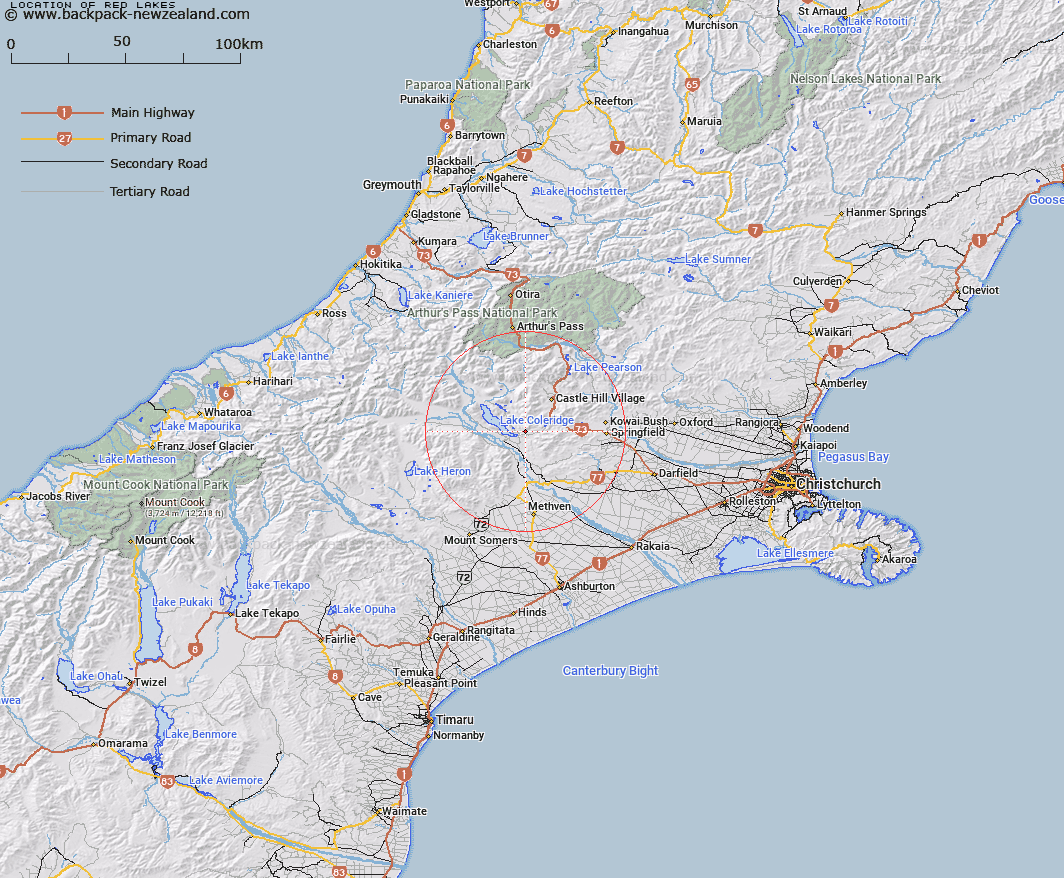
Map showing location of Red Lakes


LINZ description: Two small lakes North of Coleridge Stream, 2.5km South-west of Red Hill. Block XI Coleridge Survey District.
Latitude: -43.328728
Longitude: 171.615104
Northing: 5201748.3
Easting: 1487722.3
Land District: Canterbury
Feat Type: Lake


Scroll down to see a more detailed road map and below that a topographical map showing the location of Red Lakes. The road map has been supplied by openstreetmap and the topographical map of Red Lakes has been supplied by Land Information New Zealand (LINZ).

Yes you can use the top static map for you school/university project or personal website with a link back. Contact me for any commercial use.

Red Lakes Map New Zealand


New Zealand places in our database
[ A ] [ B ] [ C ] [ D ] [ E ] [ F ] [ G ] [ H ] [ I ] [ J ] [ K ] [ L ] [ M ] [ N ] [ O ] [ P ] [ Q ] [ R ] [ S ] [ T ] [ U ] [ V ] [ W ] [ X ] [ Y ] [ Z ]


Closest 20 Lakes to Red Lakes

Lake Georgina ( 4km )   Lake Lyndon ( 7.52km )   Lake Coleridge ( 10.23km )   Lake Evelyn ( 10.54km )   Lake Ida ( 12.15km )   Lake Selfe ( 12.55km )   Lake Catherine ( 12.69km )   Mystery Tarn ( 14.09km )   Lake Henrietta ( 14.46km )   Lake Rubicon ( 17.44km )   Lake Lilian ( 18.66km )   Casey Tarn ( 27.52km )   Vagabonds Inn ( 28.78km )   Lake Pearson ( 29.01km )   Lake Marymere ( 30.48km )   Lake Hawdon ( 31.42km )   Lake Grasmere ( 32.17km )   Lake Sarah ( 33.73km )   Blackwater Lake ( 34.49km )   Seagull Lake ( 35.97km )   Manuka Lake ( 37.43km )   Lake Emily ( 39.71km )   Lake Heron ( 39.8km )   Quagmire Tarn ( 39.94km )   Windy Tarn ( 40.89km )   Lake Letitia ( 40.91km )   Maori Lakes ( 44.63km )   Lake Crichton ( 45.66km )   Ariels Tarns ( 46.02km )   Margarets Tarn ( 46.22km )   Mavis Lake ( 47.53km )   Lake Browning ( 47.85km )   Lake Browning/Whakarewa ( 47.85km )   Lake Misery ( 47.87km )   Lake Trinity ( 50.09km )   Lake Anna ( 50.43km )   Lake Sally ( 50.63km )   Lake Florence ( 50.66km )   Spider Lakes ( 50.73km )   Lake Donne ( 50.91km )