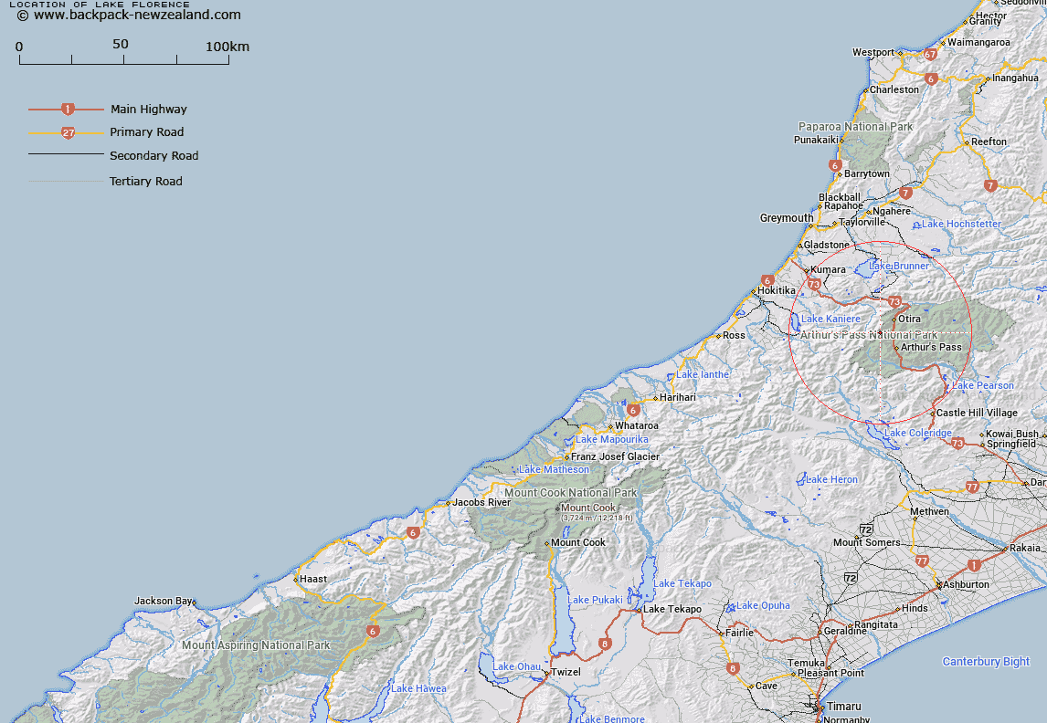
Map showing location of Lake Florence


LINZ description: Lake at the head of the Rolleston River, high on the slopes of "Anderson Peak". Arthur's Pass Survey District.
Latitude: -42.881136
Longitude: 171.49837
Northing: 5251291.1
Easting: 1477367.9
Land District: Westland
Feat Type: Lake


Scroll down to see a more detailed road map and below that a topographical map showing the location of Lake Florence. The road map has been supplied by openstreetmap and the topographical map of Lake Florence has been supplied by Land Information New Zealand (LINZ).

Yes you can use the top static map for you school/university project or personal website with a link back. Contact me for any commercial use.

Lake Florence Map New Zealand


New Zealand places in our database
[ A ] [ B ] [ C ] [ D ] [ E ] [ F ] [ G ] [ H ] [ I ] [ J ] [ K ] [ L ] [ M ] [ N ] [ O ] [ P ] [ Q ] [ R ] [ S ] [ T ] [ U ] [ V ] [ W ] [ X ] [ Y ] [ Z ]


Closest 20 Lakes to Lake Florence

Lake Misery ( 5.46km )   Margarets Tarn ( 5.84km )   Ariels Tarns ( 9.27km )   Mavis Lake ( 11.99km )   Lake Anna ( 12.53km )   Lake Sally ( 13.54km )   Lake Browning/Whakarewa ( 14.52km )   Lake Browning ( 14.52km )   Lake Kaurapataka ( 19.35km )   Lake Poerua ( 19.35km )   Lake Julia ( 21.08km )   Lake Ida ( 21.22km )   Lake Ruby ( 22.78km )   Lake Swan ( 25.47km )   Lake Minchin ( 26.46km )   Casey Tarn ( 26.54km )   Okuku Reservoir ( 27.57km )   Lake Whitestone ( 27.69km )   Lake Morgan ( 29.02km )   Lake Kaniere ( 29.17km )   Lake Sarah ( 29.34km )   Bell Dam ( 29.81km )   Kangaroo Lake ( 29.82km )   Lake Brunner (Moana) ( 29.99km )   Manks Tarn ( 30.3km )   Lake Grasmere ( 30.37km )   Lake Mudgie ( 31.47km )   Lady Lake ( 31.99km )   Swans Retreat Lagoon ( 31.99km )   Kumara Reservoir ( 32.29km )   Lake Arthur ( 32.6km )   Lake Lilian ( 32.78km )   Kapitia Reservoir ( 33.25km )   Kapitea Reservoir ( 33.25km )   Lake Pearson ( 33.51km )   Mystery Tarn ( 36.61km )   Lake Hawdon ( 37.81km )   Lake Haupiri ( 38.03km )   Lake Catherine ( 38.22km )   Lake Henrietta ( 38.71km )