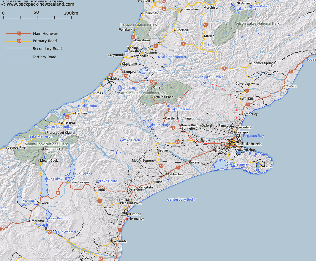
Map showing location of Pioneer Stream


LINZ description: Left bank tributary of Garry River rising 1km East of Trig. 6751 (Geodetic Code A9UP), flowing southward and joining Garry River 1km upstream of Blowhard Stream. Block IX, Mount Thomas Survey District.
Latitude: -43.148908
Longitude: 172.27479
Northing: 5222393.8
Easting: 1541032.1
Land District: Canterbury
Feat Type: Stream


Scroll down to see a more detailed road map and below that a topographical map showing the location of Pioneer Stream. The road map has been supplied by openstreetmap and the topographical map of Pioneer Stream has been supplied by Land Information New Zealand (LINZ).

Yes you can use the top static map for you school/university project or personal website with a link back. Contact me for any commercial use.

Pioneer Stream Map New Zealand


New Zealand places in our database
[ A ] [ B ] [ C ] [ D ] [ E ] [ F ] [ G ] [ H ] [ I ] [ J ] [ K ] [ L ] [ M ] [ N ] [ O ] [ P ] [ Q ] [ R ] [ S ] [ T ] [ U ] [ V ] [ W ] [ X ] [ Y ] [ Z ]


Closest 20 Streams to Pioneer Stream

Blowhard Stream ( 1.38km )   Garry River ( 2.06km )   Ribbonwood Stream ( 4.05km )   Maori Stream ( 4.37km )   Pinchgut Stream ( 4.57km )   Cattlepeak Stream ( 4.6km )   Bald Hills Stream ( 5km )   Okuku River South Branch ( 5.02km )   Wharfedale Stream ( 5.31km )   Glentui River ( 5.55km )   Whare Stream ( 5.83km )   Dorman Stream ( 5.94km )   Gorge Stream ( 6.23km )   Duck Creek ( 6.51km )   Retreat Stream ( 6.67km )   Cascade Stream ( 6.91km )   Washpool Stream ( 7.29km )   Richardson Stream ( 7.52km )   Tapley Stream ( 7.6km )   Dog Leg Stream ( 8.02km )   Broom Stream ( 8.36km )   Round Hill Stream ( 8.58km )   Ladbrook Stream ( 8.67km )   Kingsdown Stream ( 8.91km )   Canary Stream ( 8.94km )   Firewood Stream ( 9.84km )   Fox Creek ( 10.39km )   Pancake Stream ( 10.44km )   Ashley River ( 10.67km )   Ashley River/Rakahuri ( 10.67km )   Long Spur Stream ( 10.82km )   Okuku Downs Stream ( 11km )   Five Gully Stream ( 11.84km )   Billy Stream ( 12.11km )   Kowhai Stream ( 12.14km )   Ashley Gorge Drain ( 12.21km )   Snowdale Stream ( 12.29km )   Mount Thomas Stream ( 12.65km )   Boundary Stream ( 13.07km )   Oxford Creek ( 13.63km )