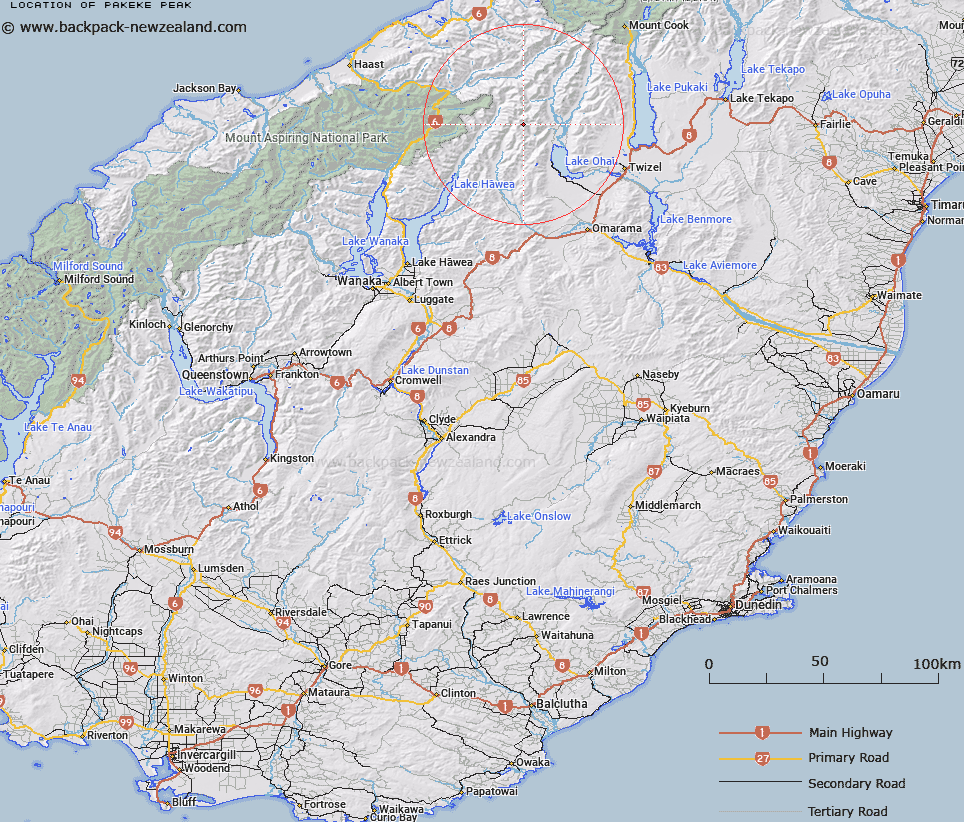
Map showing location of Pakeke Peak


LINZ description: Peak at height 2237m in the Barrier Range, less than 4km south-east of Mount Huxley.
Latitude: -44.097142
Longitude: 169.707578
Northing: 5112065.6
Easting: 1336459.3
Land District: Otago
Feat Type: Hill


Scroll down to see a more detailed road map and below that a topographical map showing the location of Pakeke Peak. The road map has been supplied by openstreetmap and the topographical map of Pakeke Peak has been supplied by Land Information New Zealand (LINZ).

Yes you can use the top static map for you school/university project or personal website with a link back. Contact me for any commercial use.

Pakeke Peak Map New Zealand


New Zealand places in our database
[ A ] [ B ] [ C ] [ D ] [ E ] [ F ] [ G ] [ H ] [ I ] [ J ] [ K ] [ L ] [ M ] [ N ] [ O ] [ P ] [ Q ] [ R ] [ S ] [ T ] [ U ] [ V ] [ W ] [ X ] [ Y ] [ Z ]


Closest 20 Hills to Pakeke Peak

Mount Huxley ( 3.73km )   Paku Peak ( 3.84km )   Belfry Peak ( 4.16km )   Chosspile Peaks ( 4.39km )   Temple Peak ( 4.66km )   Abseil Peak ( 4.68km )   Steeple Peak ( 4.93km )   Hiwiroa Mount ( 5.04km )   Bruce Peak ( 5.13km )   College Peak ( 6.03km )   Stevenson Peak ( 6.22km )   Soloist Peak ( 6.42km )   Protuberance Peak ( 6.74km )   Mount Maitland ( 7.13km )   Mount Wyn Irwin ( 7.31km )   Mount Hammerack ( 7.33km )   Rabbiters Peak ( 7.61km )   Mount Calvin ( 8.46km )   Shingle Hill ( 8.53km )   Elusive Peak ( 8.65km )   Ram Hill ( 9km )   Anita Peak ( 9.7km )   Mount Barth ( 10.83km )   Mount Ferguson ( 11.87km )   Mount Enderby ( 12.88km )   Mount Heim ( 12.98km )   Mount Holdsworth ( 13.22km )   Mount Tylee ( 13.34km )   Boanerges ( 13.4km )   Mount Greenfield ( 13.7km )   Mount Glen Lyon ( 13.75km )   Mount Peterson ( 13.88km )   Mount Rigel ( 15km )   Mount Strauchon ( 15.12km )   Docherty Peak ( 15.36km )   Mount Stafford ( 15.37km )   Mount Sutton ( 15.48km )   Mount Giles ( 15.95km )   Mount Wilson ( 16.08km )   Adams Peak ( 16.11km )