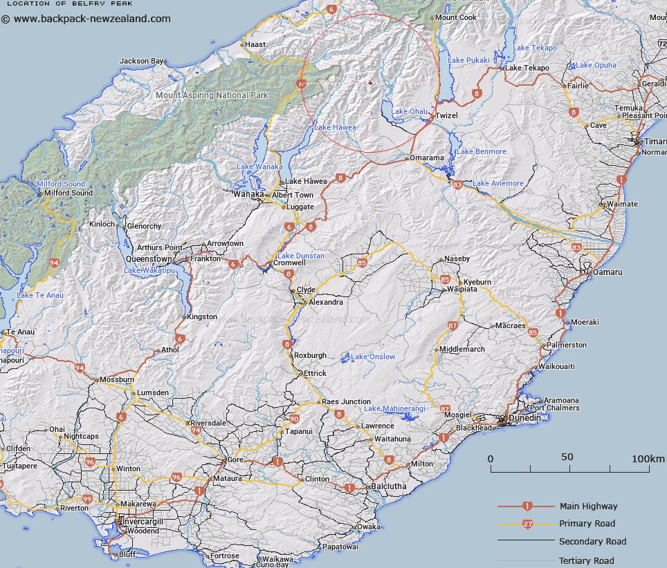
Map showing location of Belfry Peak


LINZ description: Peak north west of Lake Ohau on range between two forks of Temple Creek.
Latitude: -44.080723
Longitude: 169.754362
Northing: 5114038.2
Easting: 1340132.3
Land District: Otago
Feat Type: Hill


Scroll down to see a more detailed road map and below that a topographical map showing the location of Belfry Peak. The road map has been supplied by openstreetmap and the topographical map of Belfry Peak has been supplied by Land Information New Zealand (LINZ).

Yes you can use the top static map for you school/university project or personal website with a link back. Contact me for any commercial use.

Belfry Peak Map New Zealand


New Zealand places in our database
[ A ] [ B ] [ C ] [ D ] [ E ] [ F ] [ G ] [ H ] [ I ] [ J ] [ K ] [ L ] [ M ] [ N ] [ O ] [ P ] [ Q ] [ R ] [ S ] [ T ] [ U ] [ V ] [ W ] [ X ] [ Y ] [ Z ]


Closest 20 Hills to Belfry Peak

Temple Peak ( 1.15km )   Bruce Peak ( 1.31km )   Steeple Peak ( 2.52km )   Rabbiters Peak ( 3.94km )   Pakeke Peak ( 4.16km )   Ram Hill ( 5.44km )   Mount Huxley ( 6.16km )   Soloist Peak ( 6.28km )   Stevenson Peak ( 6.3km )   Abseil Peak ( 6.51km )   Paku Peak ( 6.94km )   College Peak ( 7.1km )   Protuberance Peak ( 7.26km )   Chosspile Peaks ( 7.67km )   Hiwiroa Mount ( 7.69km )   Mount Hammerack ( 7.85km )   Shingle Hill ( 7.92km )   Anita Peak ( 8.87km )   Mount Maitland ( 9.57km )   Mount Glen Lyon ( 9.59km )   Boanerges ( 10.8km )   Elusive Peak ( 10.84km )   Mount Wyn Irwin ( 11.46km )   Mount Calvin ( 12.61km )   Mount Strauchon ( 14.05km )   Taiaha Peak ( 14.07km )   Mount Barth ( 14.9km )   McNulty Peak ( 15.05km )   Mount Holdsworth ( 15.09km )   Mount Mackenzie ( 15.11km )   Mount McKenzie ( 15.11km )   Mount Tylee ( 15.15km )   Mount Glenmary ( 15.25km )   Mount Ferguson ( 15.26km )   Ben Ross ( 15.37km )   Mount Greenfield ( 15.42km )   Mount Enderby ( 15.47km )   Mount Wilson ( 15.54km )   Backbone Peak ( 15.7km )   Adams Peak ( 16.01km )